Abbott (Live.com)
Abilene (Google Maps)
Abilene (MapQuest)
Abilene (Live.com)
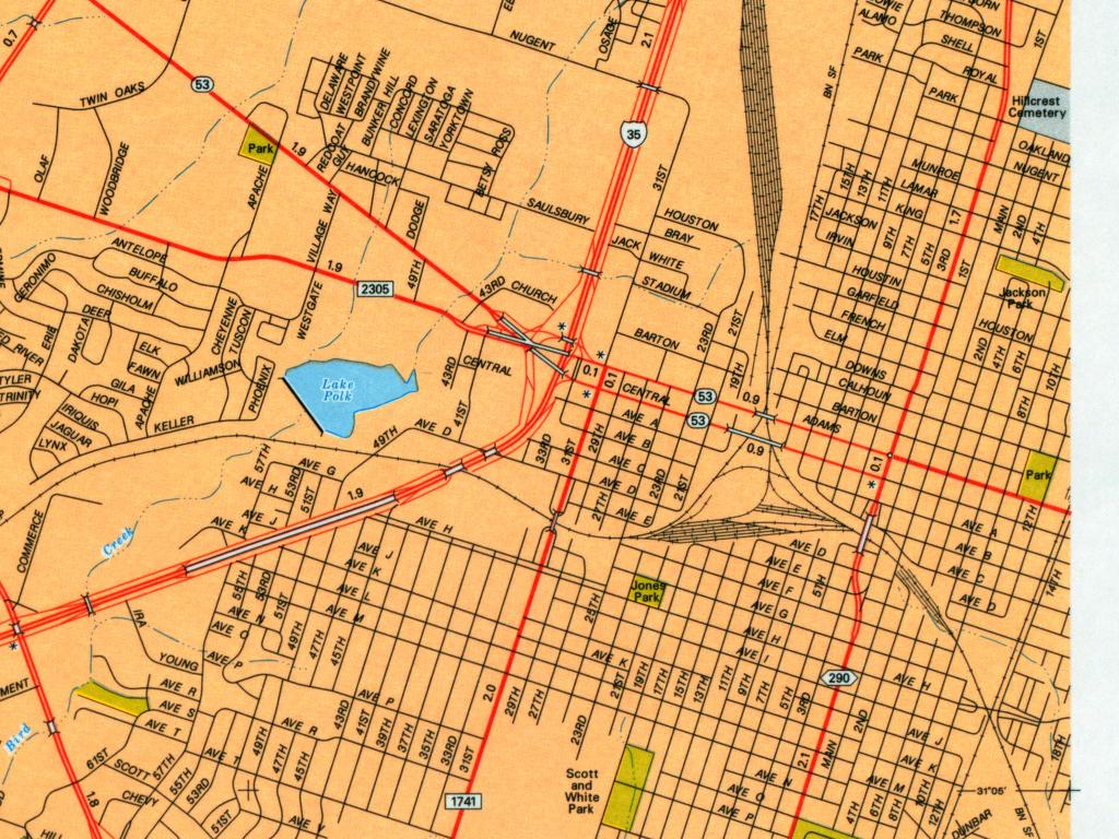
Abilene - GIS Viewer (City of Abilene)
Alvin - GIS Viewer (City of Alvin)
Amarillo (Amarillo Outside)
Amarillo (Google Maps)
Amarillo (Yahoo Travel)
Amarillo - Main Routes (Texas Outside)
Angleton (Google Maps)
Aransas Pass (Google Maps)
Archer City (MapQuest)
Arlington (Google Maps)
Arlington (Yahoo Travel)
Arlington - GIS Data (City of Arlington)
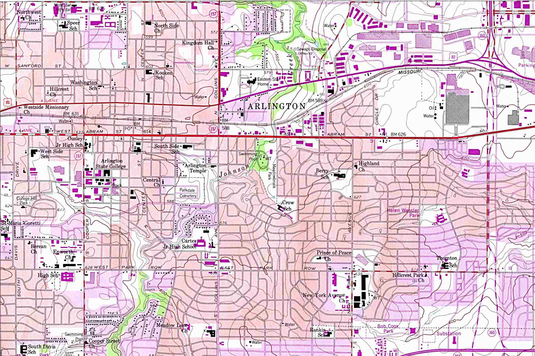
Arlington - Topographic Map 1:24,000 U.S.G.S. 1959 photo revised 1981 (318K) (University of Texas Map Collection)
Austin Maps Page
Austin - University of Texas at Austin Campus Maps (University of Texas)
B
Ballinger (Google Maps)
Bandera - Main Routes (Texas Outside)
Bastrop (Google Maps)
Bastrop - Maps (Bastrop Texas Network)
Bay City (Google Maps)
Beaumont (Google Maps)
Beaumont (Yahoo Travel)
Beaumont - GIS Viewer (City of Beaumont)
Bellville (Bellville Chamber of Commerce)
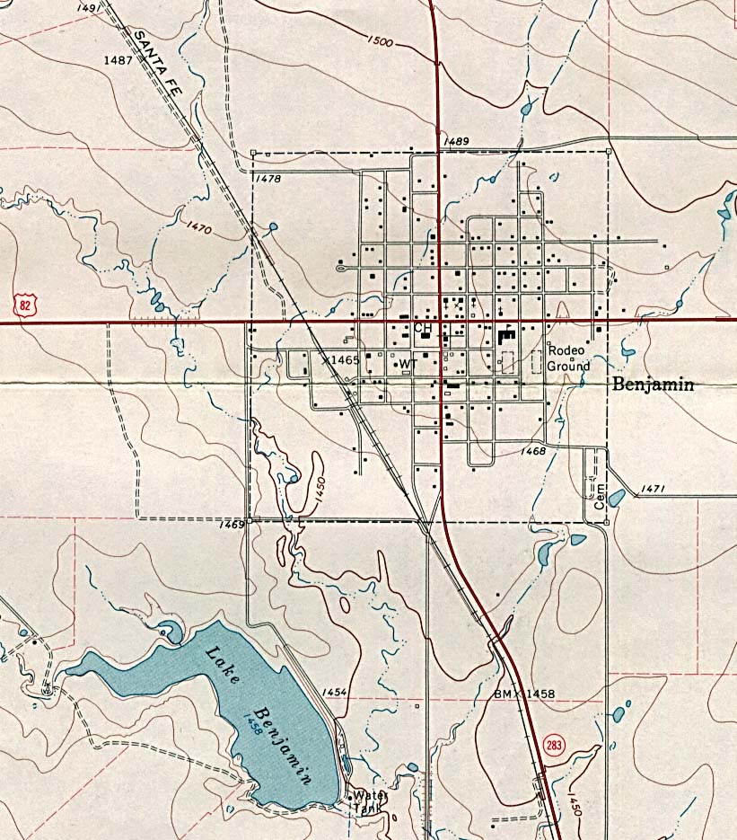
Benjamin - Topographic Map 1:24,000 U.S.G.S. 1967 (196K) (University of Texas Map Collection)
Berclair - Topographic Map 1:24,000 U.S.G.S. 1987 (425K) (University of Texas Map Collection)
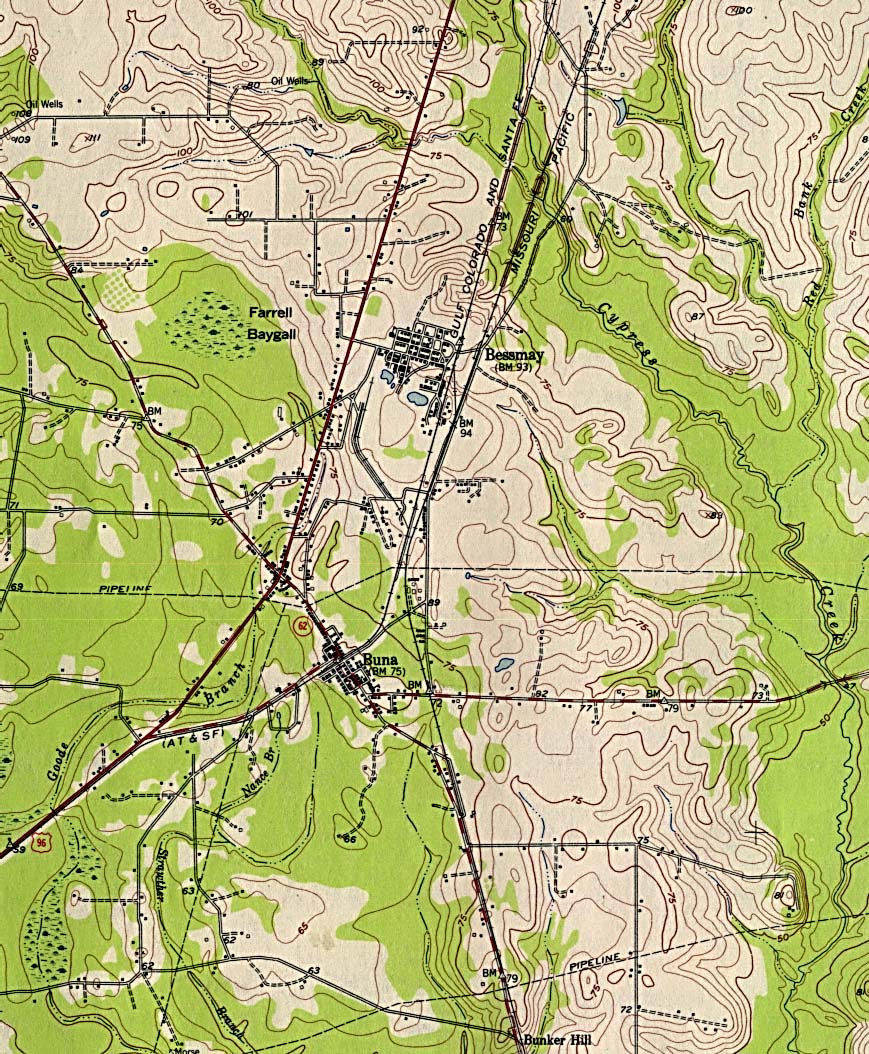
Bessmay - Topographic Map 1:62,500 U.S.G.S. 1955 (349K) (University of Texas Map Collection)
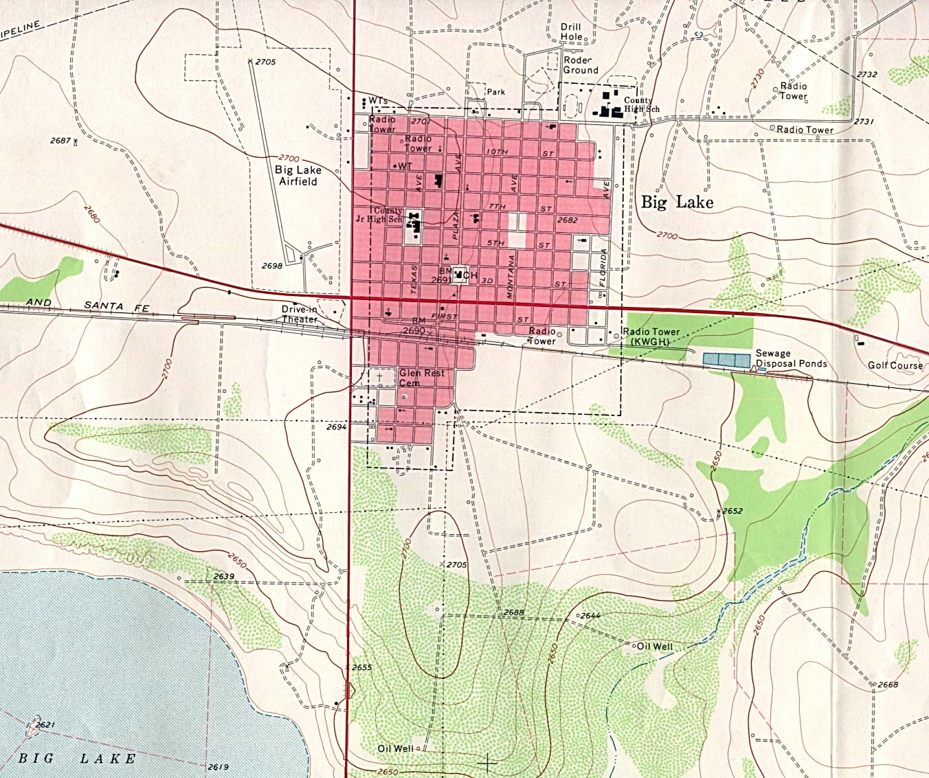
Big Lake - Topographic Map 1:24,000 U.S.G.S. 1971 (349K) (University of Texas Map Collection)
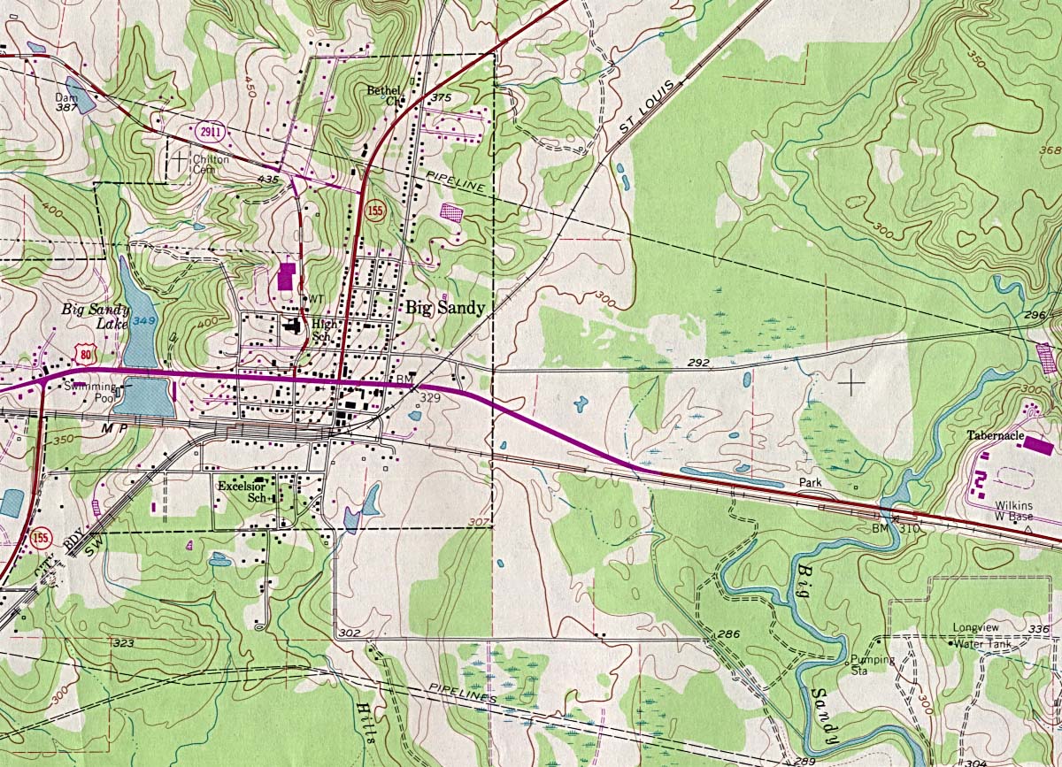
Big Sandy - Topographic Map 1:24,000 U.S.G.S. 1981 (323K) (University of Texas Map Collection)
Big Spring - Clickable Street Map (Community Link Cafe)
Blanco (Google Maps)
Bonham - Topographic Map (MapTech)
Borger (Google Maps)
Brazoria (Google Maps)
Brenham (Washington County Convention and Visitor Bureau)
Brenham - GIS Viewer (Washington County Appraisal District)
Bridge City (Google Maps)
Brownsville (Google Maps)
Brownsville - Main Routes (Texas Outside)
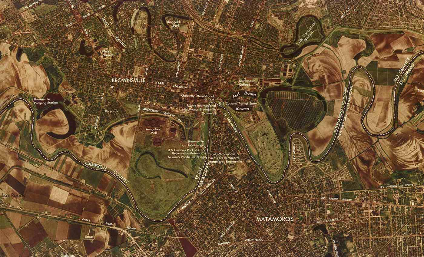
Brownsville Port of Entry (color image map) 1:25,000 U.S.G.S. 1983 (165K) (University of Texas Map Collection)
Bryan (Google Maps)
Bryan - Maps (City of Bryan)
C
Cameron (Google Maps)
Canadian (Live.com)
Candelaria (Maptech)
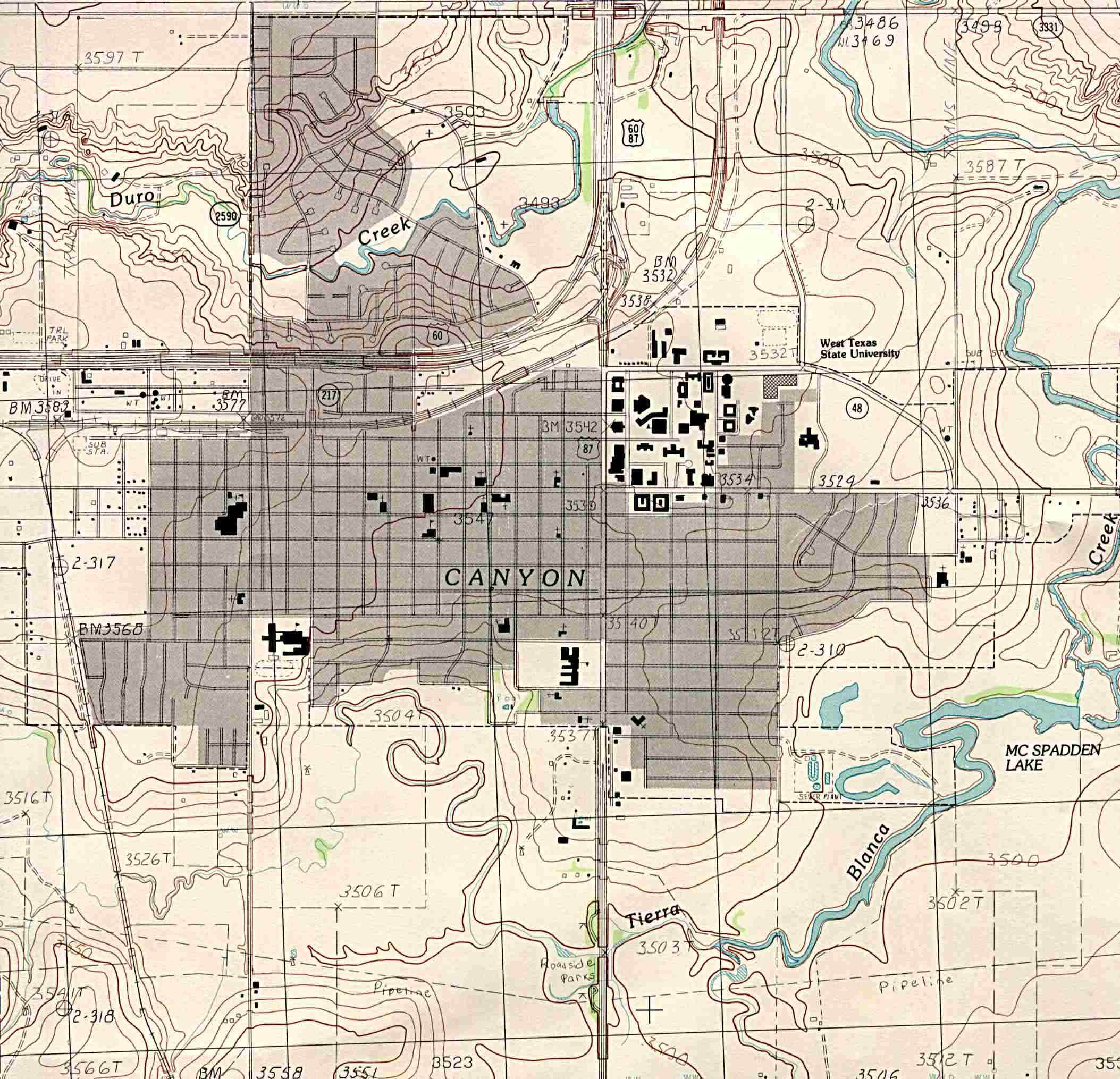
Canyon - Topographic Map 1:24,000 U.S.G.S. Provisional Edition 1984 (359K) (University of Texas Electronic Map Collection)
Canyon - West Texas A&M University Map (West Texas A&M University)
Carrollton (Google Maps)
Carrollton - Zoning Maps [pdf] (City of Carrollton)
Carthage (Google Maps)
Cedar Park (Google Maps)
Cedar Park - Maps (City of Cedar Park)
Center (Google Maps)
Cleveland (Live.com)
Clifton (Live.com)
College Station (Live.com)
College Station - Interactive Maps and GIS Data (City of College Station)
College Station - Texas A&M University Maps (Texas A&M University)
Colleyville - GIS Viewer (City of Colleyville)
Columbus (Columbus Convention and Visitors Bureau)
Columbus (Live.com)
Comanche (Live.com)
Commerce (Live.com)
Commerce - Texas A&M University-Commerce Campus Map (Texas A&M University-Commerce)
Conroe (Live.com)
Conroe - GIS/Maps (City of Conroe)
Corpus Christi (Google Maps)
Corpus Christi (Yahoo Travel)
Corpus Christi - Area Map (Corpus Christi Caller-Times)
Corpus Christi - Digital Maps (City of Corpus Christi)
Corpus Christi - Maps (City of Corpus Christi)
Corpus Christi - Superfund Sites Map (TNRCC)
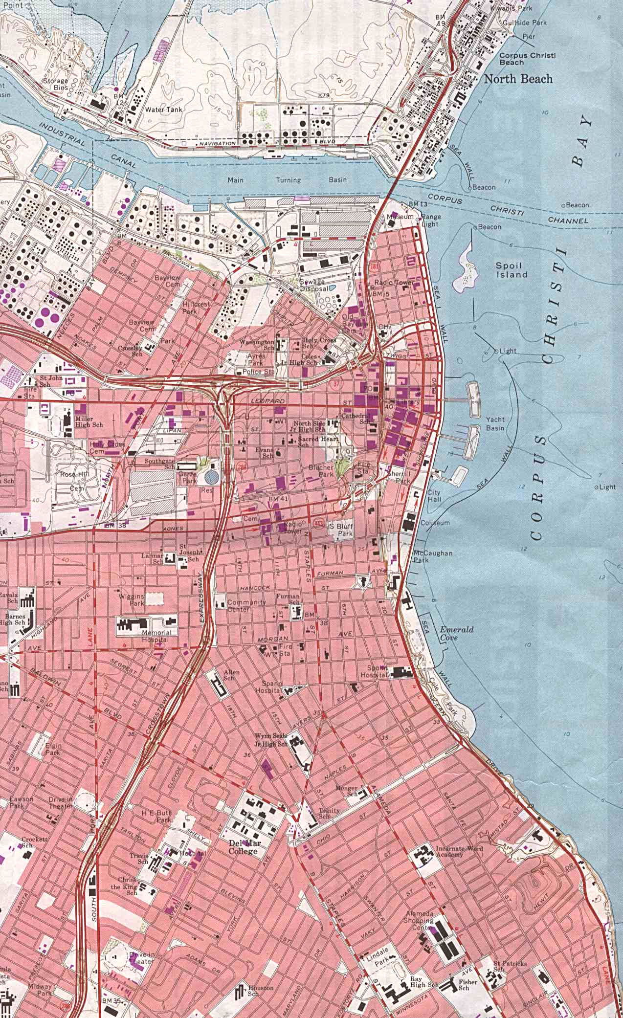
Corpus Christi - Topographic Map 1:1:24,000 U.S.G.S. 1968 photo revised 1975 (342K) (University of Texas Map Collection)
Corpus Christi - Tourist Sites (Texas Outside)
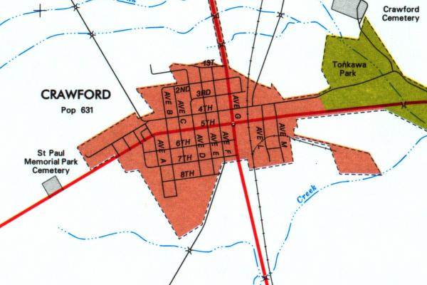
Crawford (University of Texas Map Collection/Texas Dept. of Transportation)
Crawford (Live.com)
Crawford Area (TopoZone)
Crystal City (Live.com)
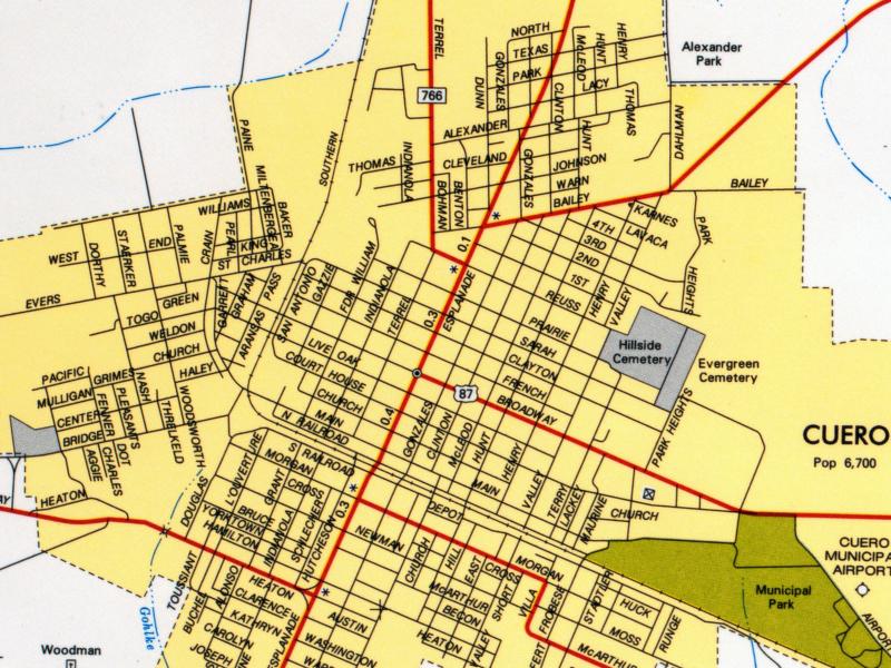
Cuero (University of Texas Map Collection/Texas Dept. of Transportation)
D
Dallas (Google Maps)
Dallas (Lonely Planet)
Dallas (Yahoo Travel)
Dallas - Bus and Rail Maps (Dallas Area Rapid Transit)
Dallas - Cotton Bowl Seating Chart (Johnnyroadtrip.com)
Dallas - Downtown (Google Maps)
Dallas - Downtown (Johnnyroadtrip.com)
Dallas - Interactive Maps (City of Dallas)
Dallas - Main Routes (Texas Outside)
Dallas - Toll Roads Clickable Map (North Texas Tollway Authority)
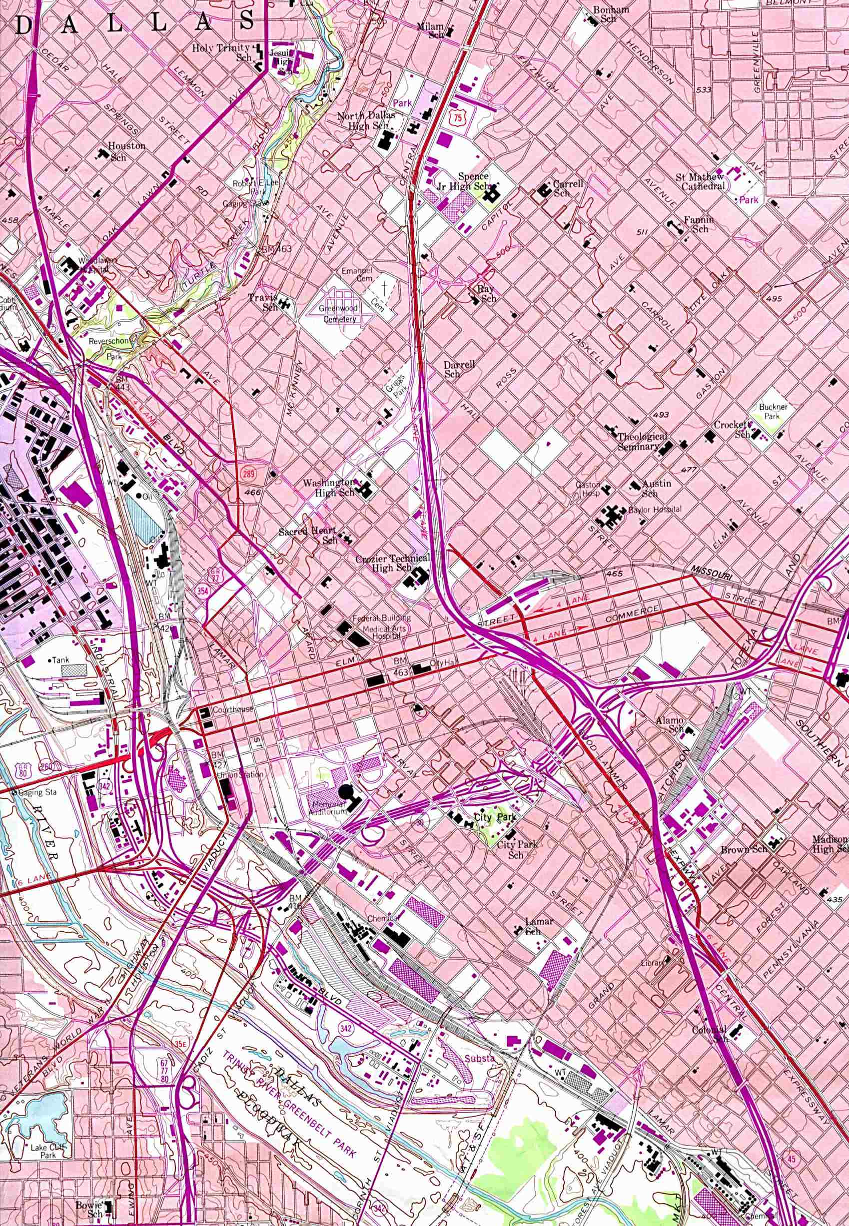
Dallas - Topographic Map 1:24,000 U.S.G.S. 1958 photo revised 1981 (538K) (University of Texas Map Collection)
Dallas - Tourist Map, Interactive (USA Today/Map Network)
Dallas County - Clickable Road Map (Community Link Cafe)
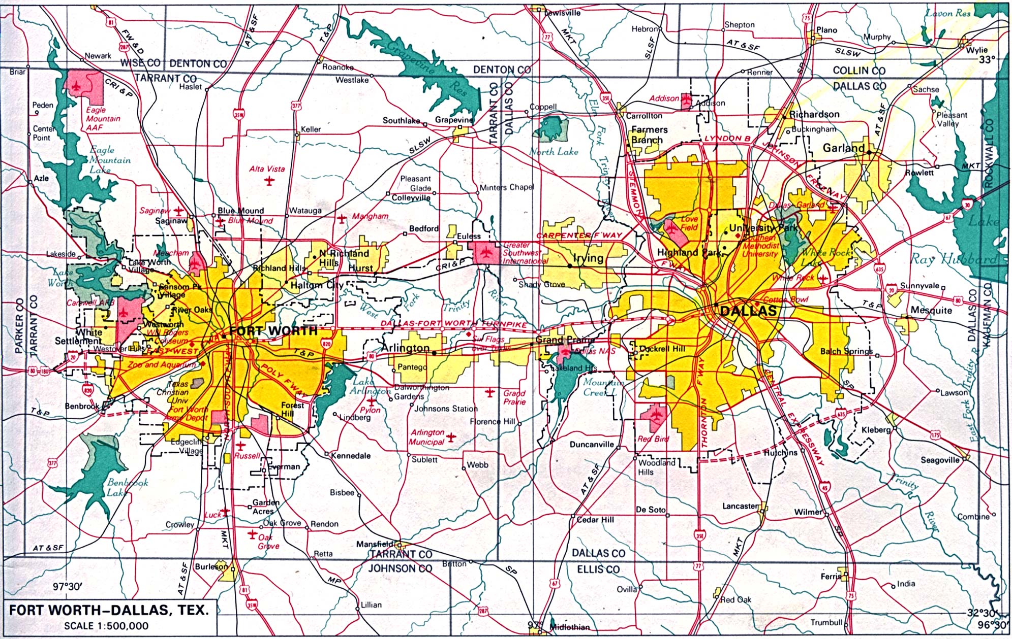
Dallas - Fort Worth 1:500,000 From the U.S. National Atlas 1970 (666K) (University of Texas Map Collection)
Dallas - Fort Worth - Clickable Highway Map (Community Link Cafe)
Dallas - Fort Worth - GIS Data including GeoData Warehouse (DFWinfo)
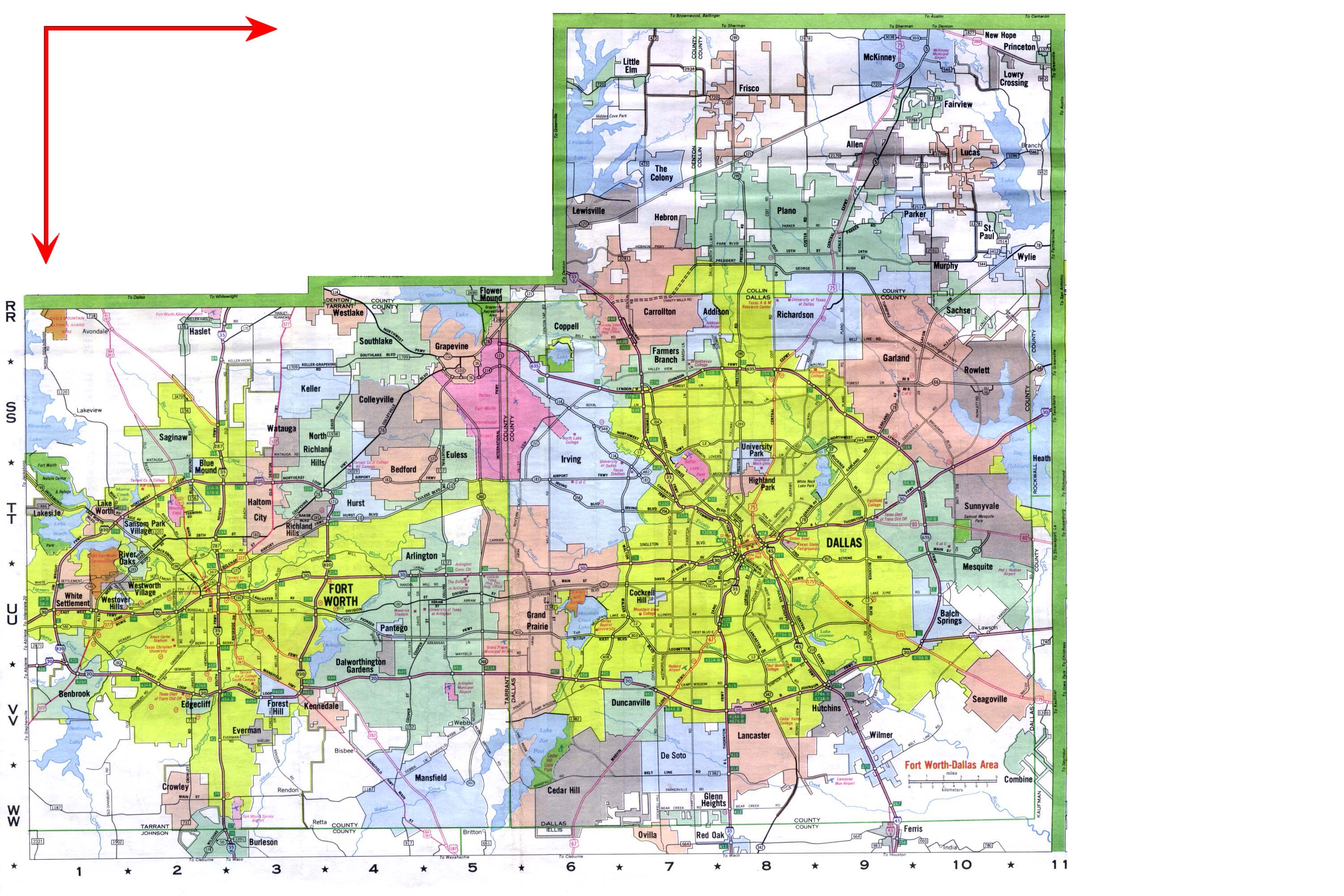
Dallas - Fort Worth Metropolitan Map 2001 (580K) (University of Texas Map Collection/Texas Dept. of Transportation)
Dallas - Fort Worth Region Maps and Aerial Photographs (North Central Texas Council of Governments)
Dallas - Fort Worth Sports Venues Clickable Map (Johnnyroadtrip.com)
Dayton (Live.com)
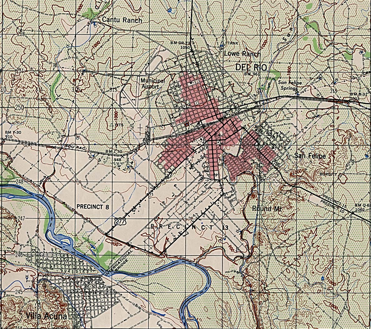
Del Rio - Topographic Map 1:50,000 A.M.S. 1947 (663K) (University of Texas Electronic Map Collection)
Denton (Google Maps)
Denton (University of North Texas)
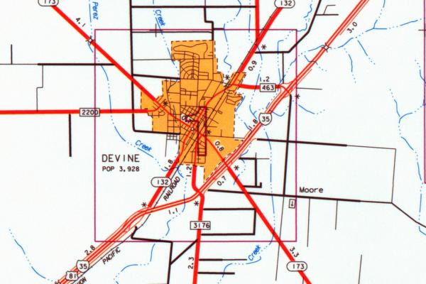
Devine (main routes) (University of Texas Map Collection/Texas Dept. of Transportation)
E
Eagle Lake (Google Maps)
Eagle Pass (Google Maps)
Edinburg (Google Maps)
El Campo (Google Maps)
El Paso (Google Maps)
El Paso (Yahoo Travel)
El Paso - Interactive Street Map (Community Link Cafe)
El Paso - Landsat Image (Christopher Small, Columbia University)
El Paso - Main Routes (Texas Outside)
El Paso - Superfund Sites Map (TNRCC)
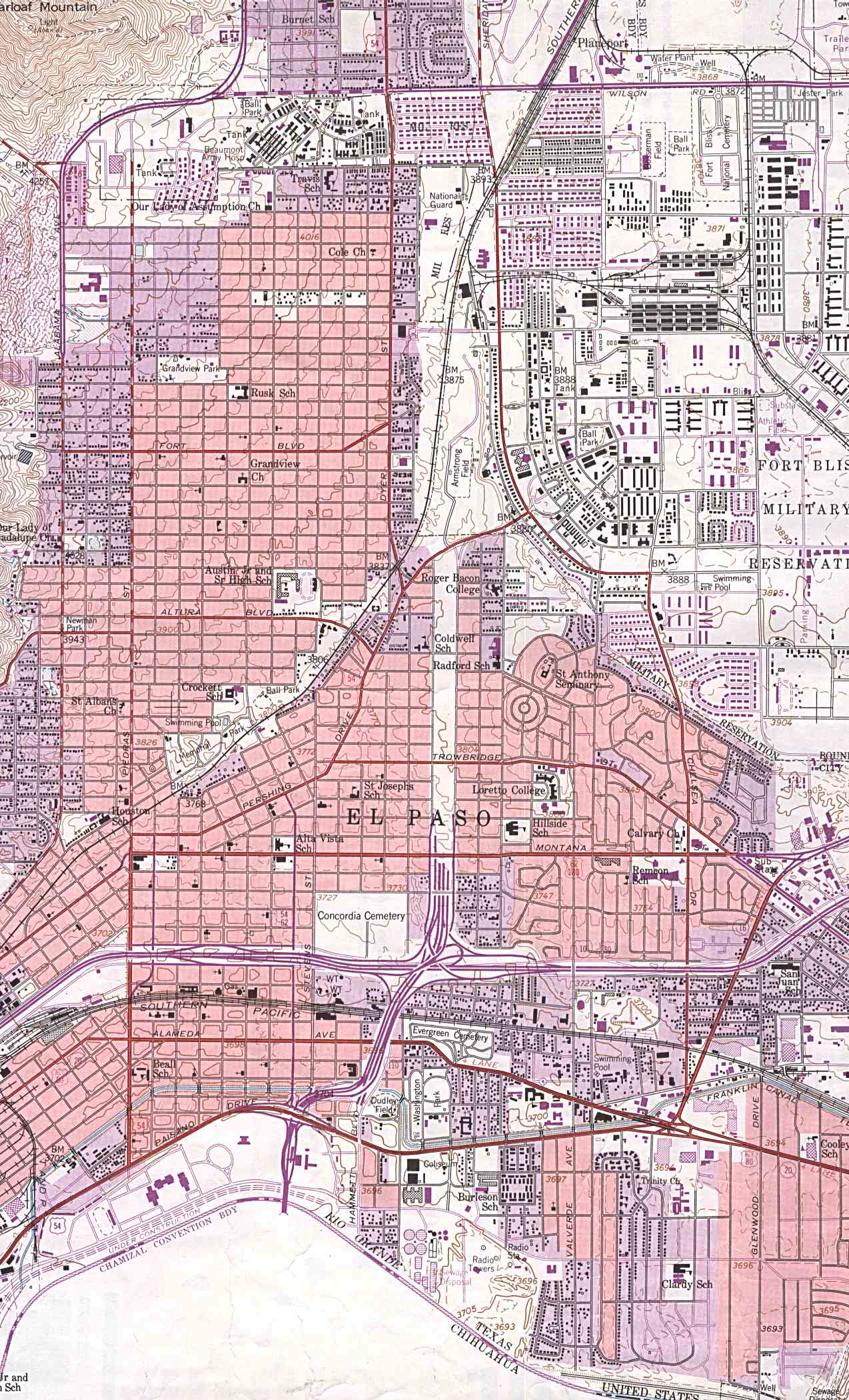
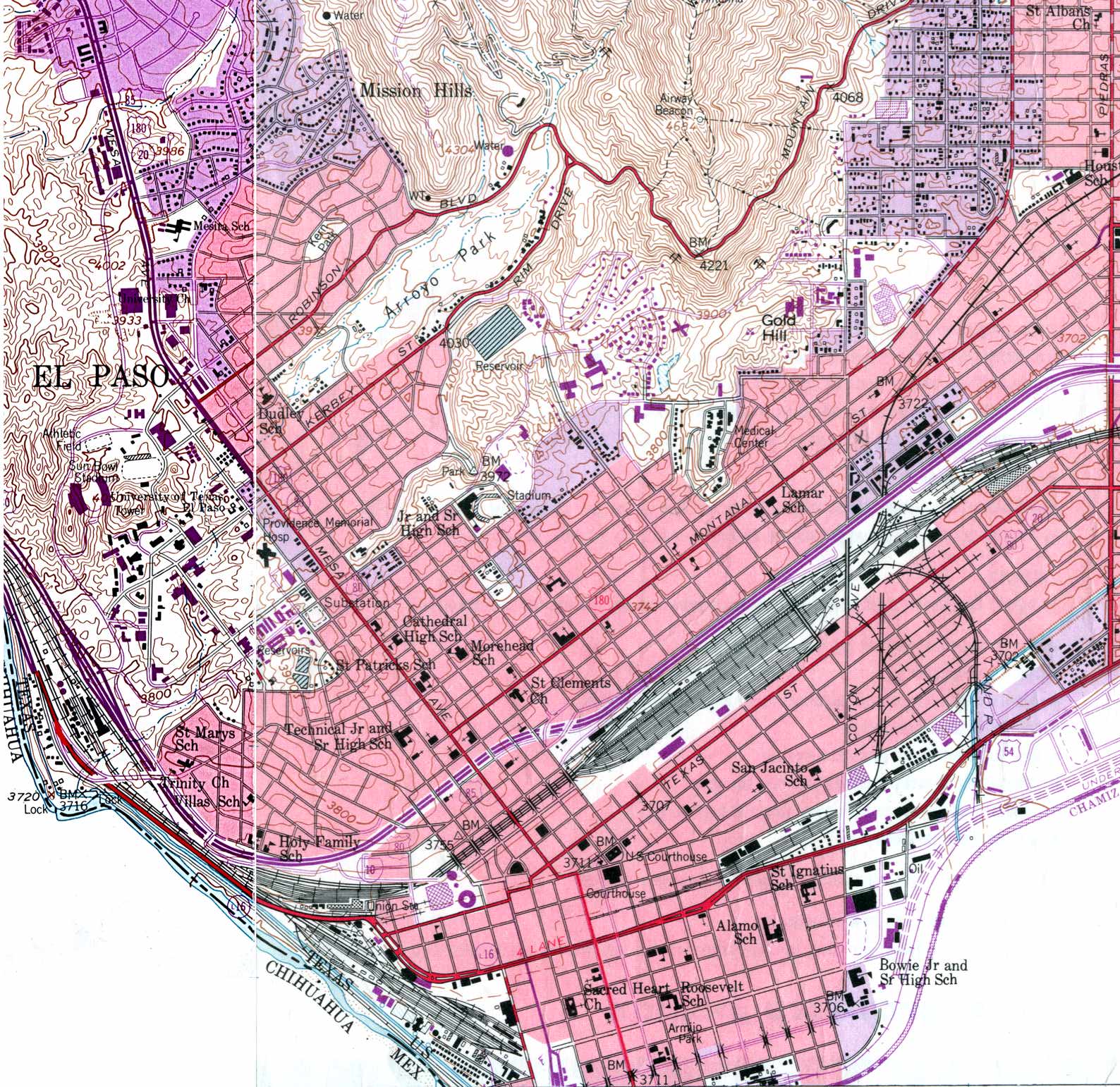
El Paso East - Topographic Map 1:24,000 U.S.G.S. 1955 photo revised 1967 and 1973 (445K) (University of Texas Map Collection)
El Paso West - Topographic Map 1:24,000 U.S.G.S. 1955 photo revised 1967 and 1973 (527K) (University of Texas Map Collection)
El Paso and El Paso County (University of Texas Map Collection/Texas Dept. of Transportation)
F
Farmer's Branch - Clickable Street Map (Community Link Cafe)
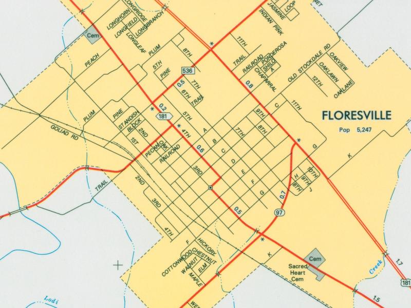
Floresville (University of Texas Map Collection/Texas Dept. of Transportation)
Flower Mound (Google Maps)
Floydada (MapQuest)
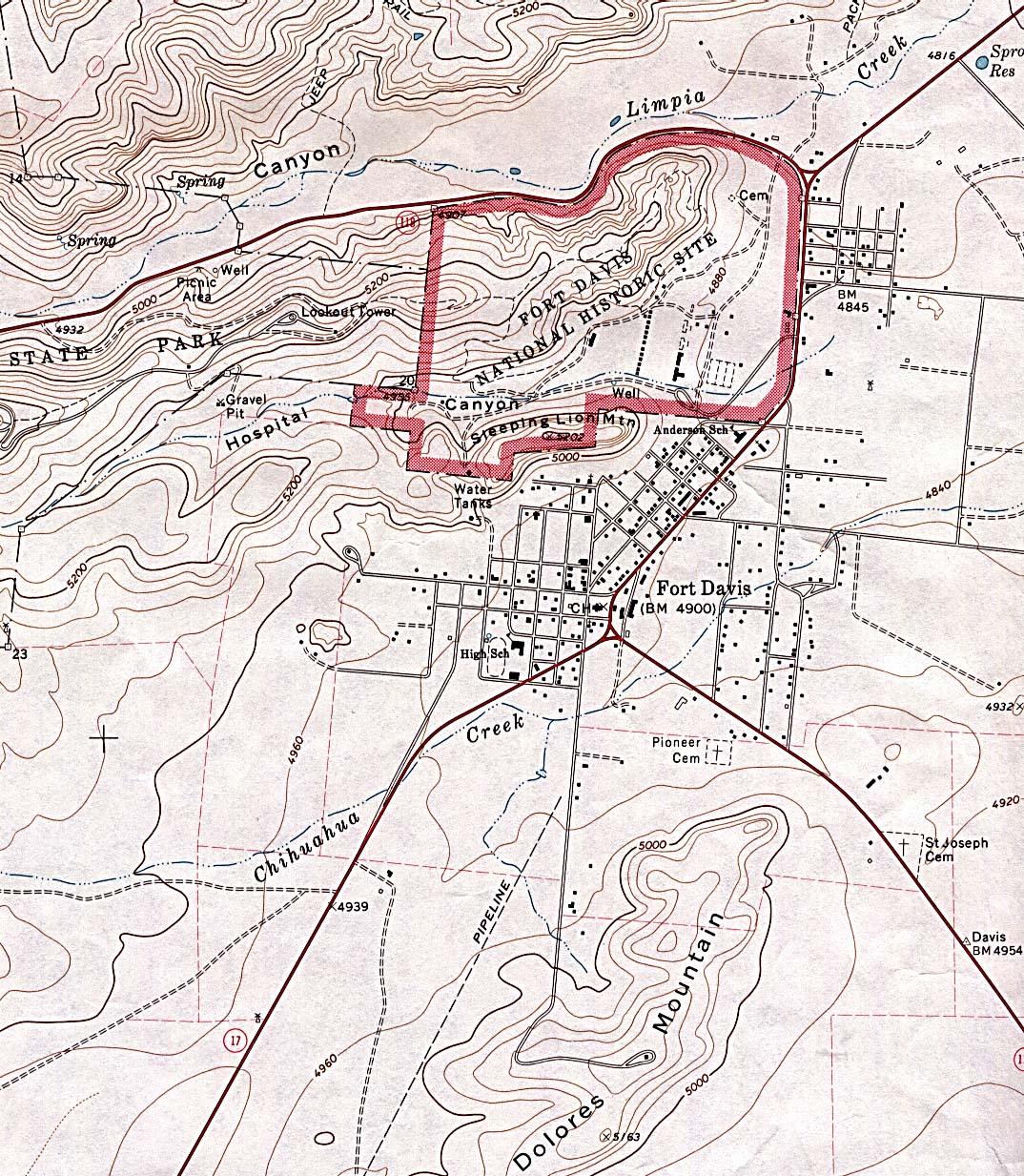
Fort Davis - Topographic Map 1:24,000 U.S.G.S. 1972 (468K) (University of Texas Map Collection)
Fort Hood [zoom in for streets] (Google Maps)
Fort Stockton (University of Texas Map Collection/Texas Dept. of Transportation)
Fort Worth, Texas (Google Maps)
Fort Worth (Yahoo Travel)
Fort Worth - Main Routes (Fort Worth Public Library)
Fort Worth - Main Routes (Texas Outside)
Fort Worth - Superfund Sites Map (TNRCC)
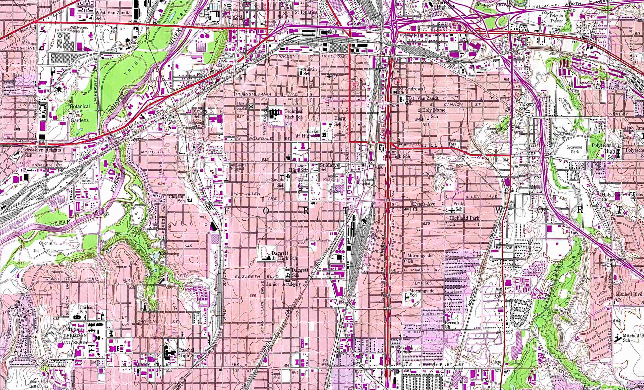
Fort Worth - Topographic Map 1:24,000 U.S.G.S. 1955 photo revised 1981 (557K) (University of Texas Electronic Map Collection)
Fort Worth - Dallas 1:500,000 From the U.S. National Atlas 1970 (666K) (University of Texas Map Collection)
Fort Worth - Dallas - GIS Data including GeoData Warehouse (DFWinfo)
Fort Worth - Dallas Metropolitan Map 2001 (580K) (University of Texas Map Collection/Texas Dept. of Transportation)
Fort Worth - DFW Region Maps and Aerial Photographs (North Central Texas Council of Governments)
Fredericksburg (Google Maps)
Fredericksburg - GIS Viewer (City of Fredericksburg)
Fredericksburg - Main Routes (Texas Outside)
Freeport/Lake Jackson Area (Google Maps)
Friendswood - GIS Viewer (City of Friendswood)
Frisco - Interactive Map (City of Frisco)
G
Galveston (Google Maps)
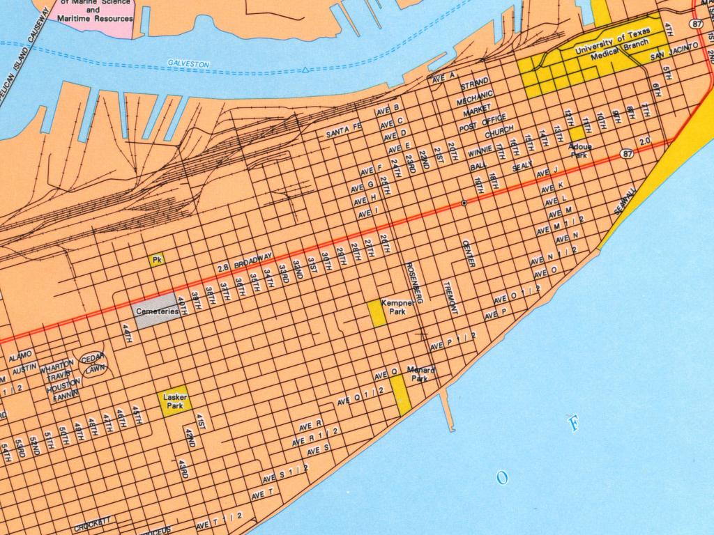
Galveston (University of Texas Map Collection/Texas Dept. of Transportation)
Galveston (Yahoo Travel)
Galveston Bay - Windsurfing Sites (Windsurfing Sports)
Galveston Maps (City of Galveston)
Galveston - Main Routes (Texas Outside)
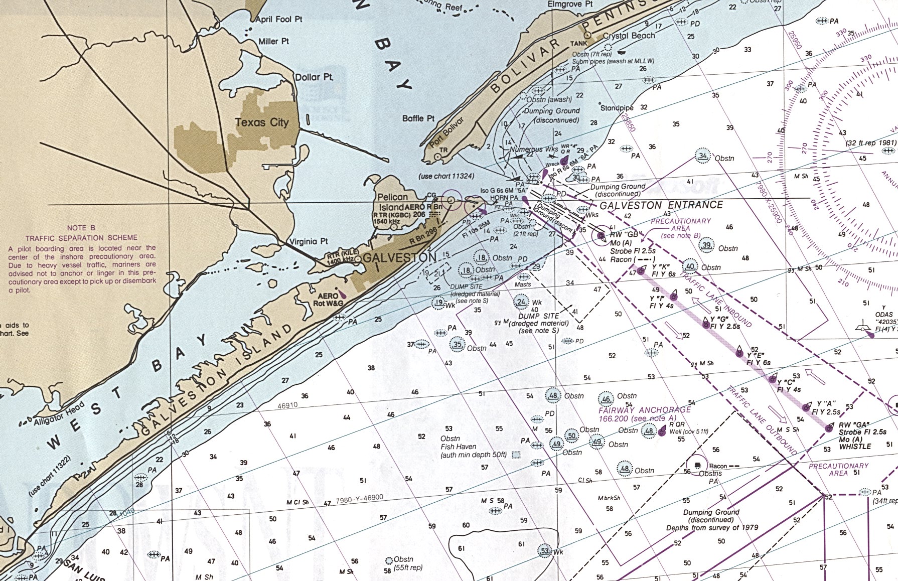
Galveston Region (nautical chart) 1:250,000 Nat. Ocean Service 1993 (659K) Not for navigational use (University of Texas Map Collection)
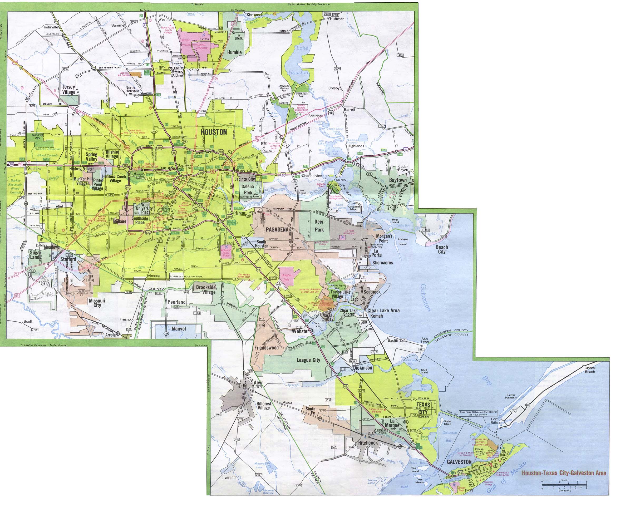
Galveston - Houston - Texas City Metropolitan Map 2001 (590K) (University of Texas Map Collection/Texas Dept. of Transportation)
Ganado (Google Maps)
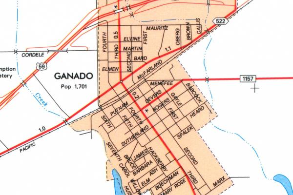
Ganado (University of Texas Map Collection/Texas Dept. of Transportation)
Garland (Google Maps)
Garland (Live.com)
Garland (Yahoo Maps)
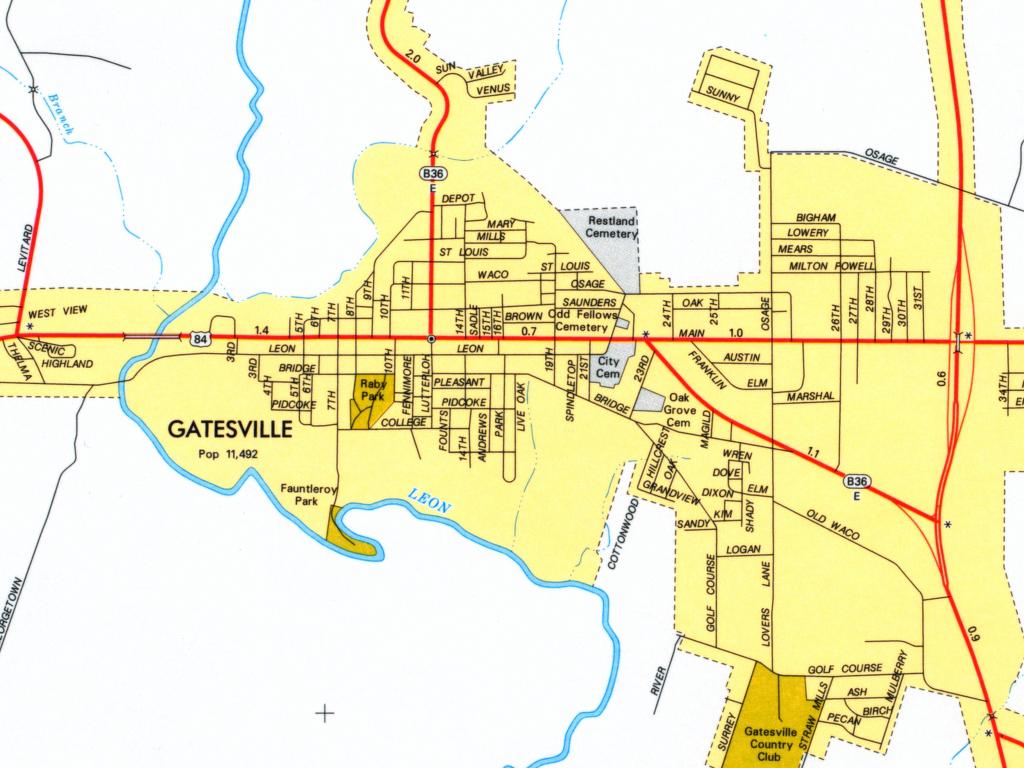
Gatesville (University of Texas Map Collection/Texas Dept. of Transportation)
Georgetown - Maps (City of Georgetown)
Giddings (Google Maps)
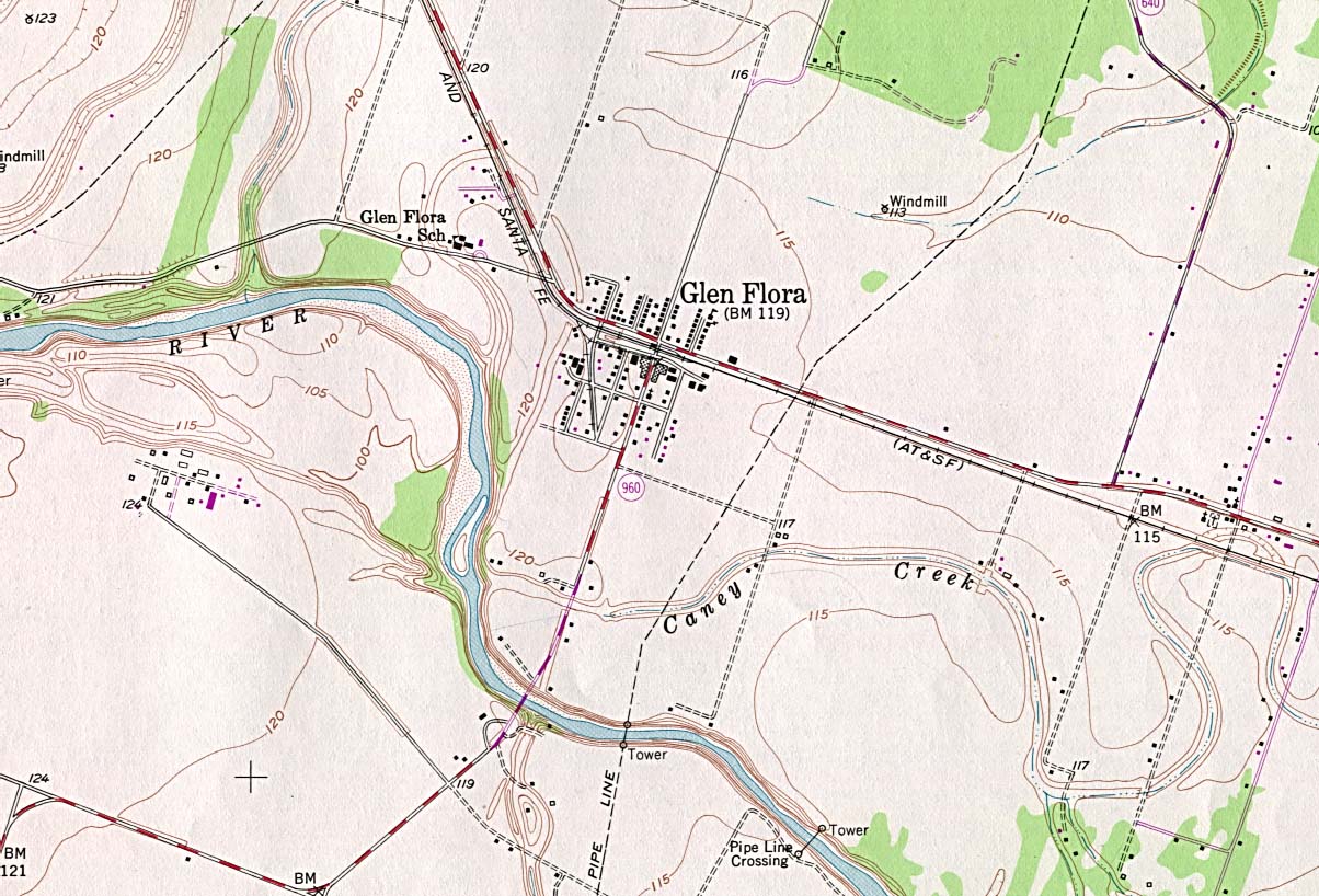
Glen Flora - Topographic Map 1:24,000 U.S.G.S. 1980 (247K) (University of Texas Map Collection)
Glen Rose - Main Routes (Texas Outside)
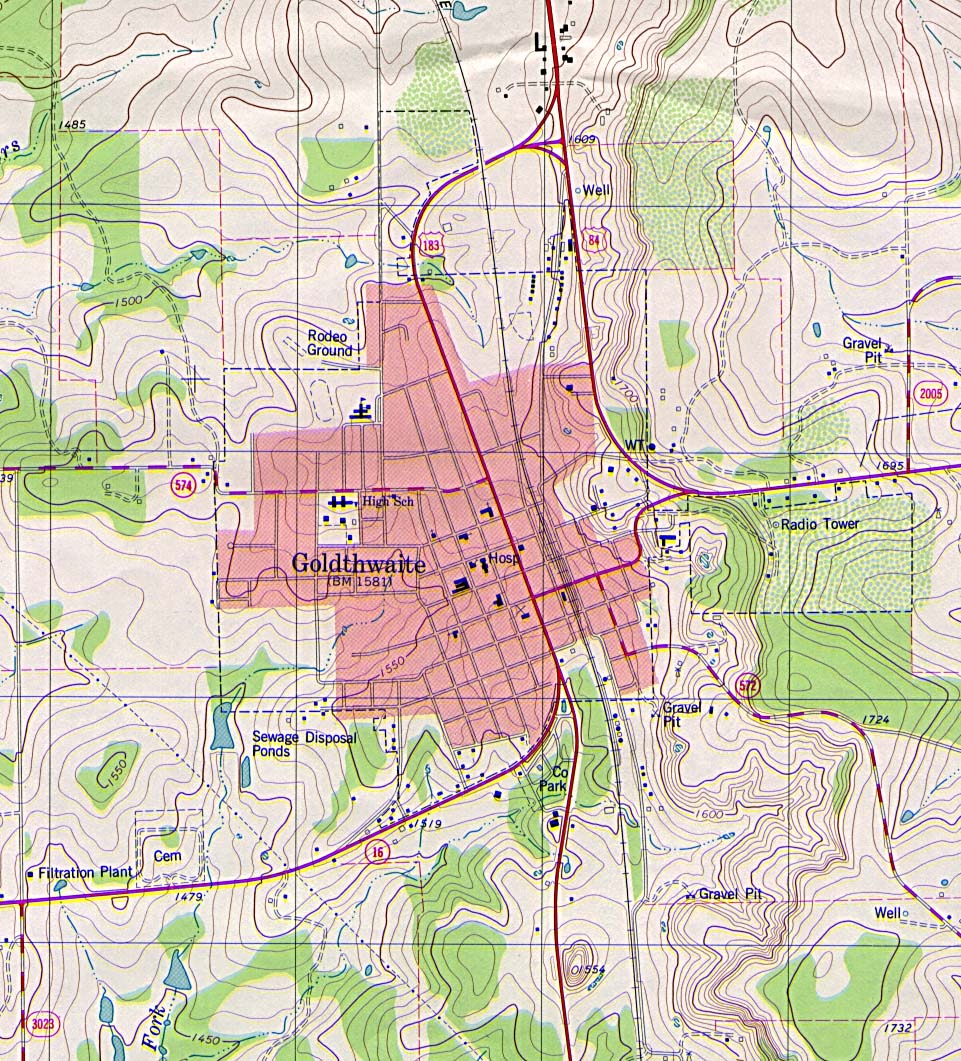
Goldthwaite - Topographic Map 1:24,000 U.S.G.S. 1980 (366K) (University of Texas Map Collection)
Goliad (Google Maps)
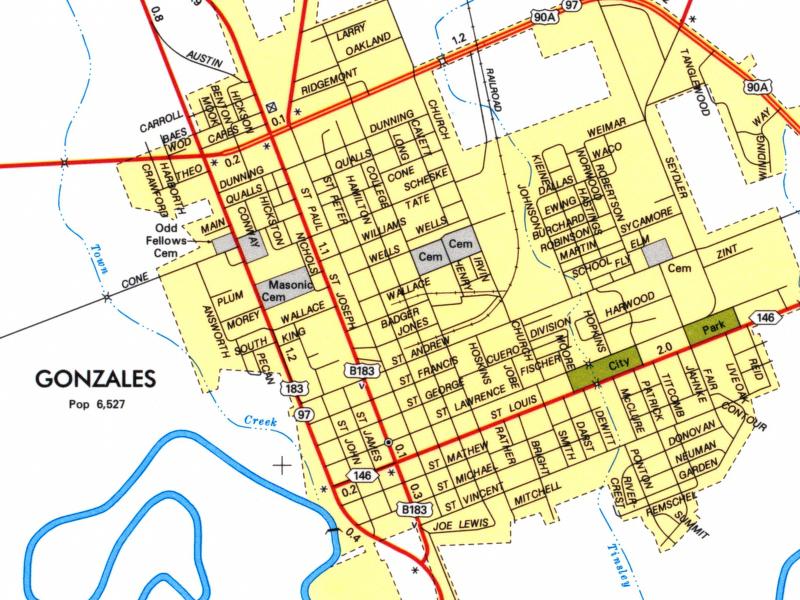
Gonzales (University of Texas Map Collection/Texas Dept. of Transportation)
Graham (Graham Chamber of Commerce)
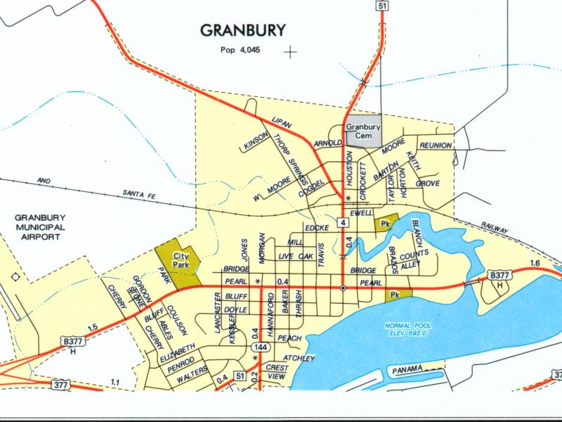
Granbury (University of Texas Map Collection/Texas Dept. of Transportation)
Grand Prairie (Google Maps)
Grapevine - Interactive Map (City of Grapevine)
Greenville - GIS and Maps (City of Greenville)
Groves (Google Maps)
H
Hallettsville (Google Maps)
Harlingen (Google Maps)
Hemphill (Google Maps)
Henderson (Google Maps)
High Island (Google Maps)
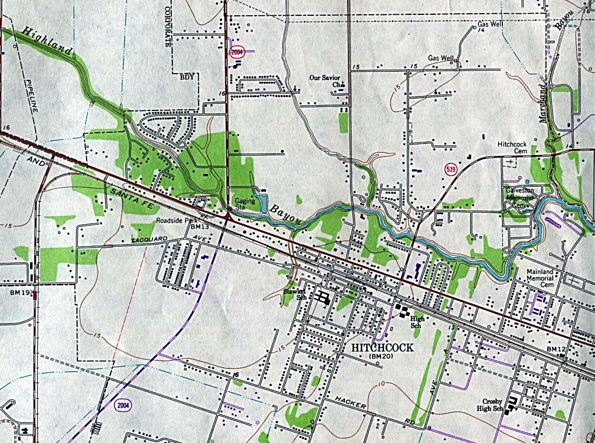
Hitchcock - Topographic Map 1:24,000 U.S.G.S. 1974 (349K) (University of Texas Map Collection)
Houston (Google Maps)
Houston (Lonely Planet)
Houston (Yahoo Travel)
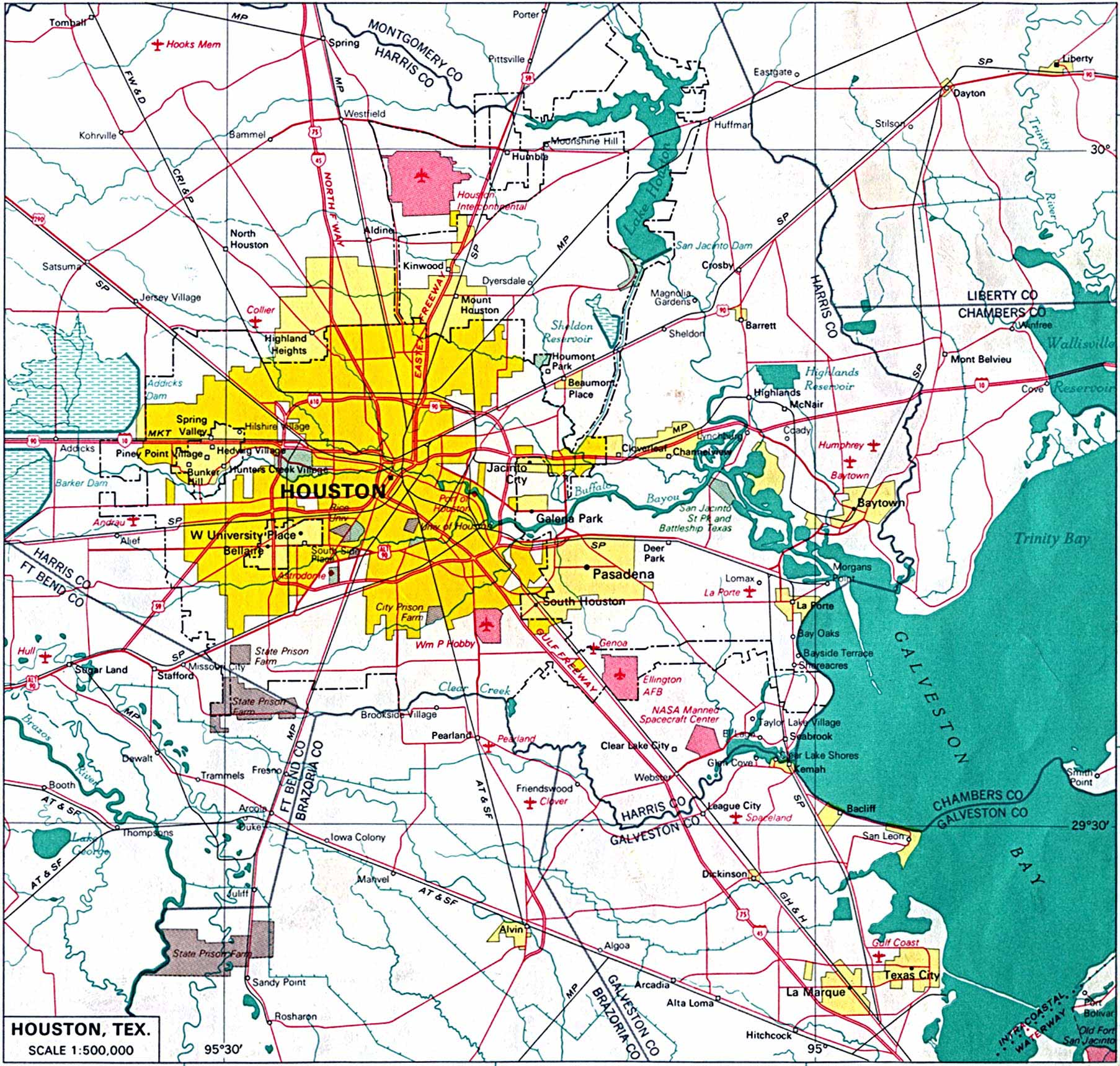
Houston (area map) 1:500,000 From the U.S. National Atlas 1970 (537K) (University of Texas Map Collection)
Houston - City Council Districts (City of Houston)
Houston - Downtown (Apartments Houston)
Houston - Downtown (Google Maps)
Houston - Downtown (Johnnyroadtrip.com)
Houston - Downtown (Treebeards)
Houston - GIS Links (Fondren Library, Rice University)
Houston - Main Routes (Johnnyroadtrip.com)
Houston - Main Routes (Texas Outside)
Houston - Property Maps (Harris County Appraisal District)
Houston - Real-Time Traffic Map (Houston Transtar)
Houston - Rice University Campus Maps (Rice University)
Houston - Superfund Sites Map (TNRCC)
Houston - Texas City - Galveston Metropolitan Map 2001 (590K) (University of Texas Map Collection/Texas Dept. of Transportation)
Houston - Toll Roads (Harris County Toll Road Authority)
Houston - Tourist Map, Interactive (USA Today/Map Network)
Humble - GIS Maps (City of Humble)
Huntsville - Sam Houston State University Maps (Sam Houston State University)
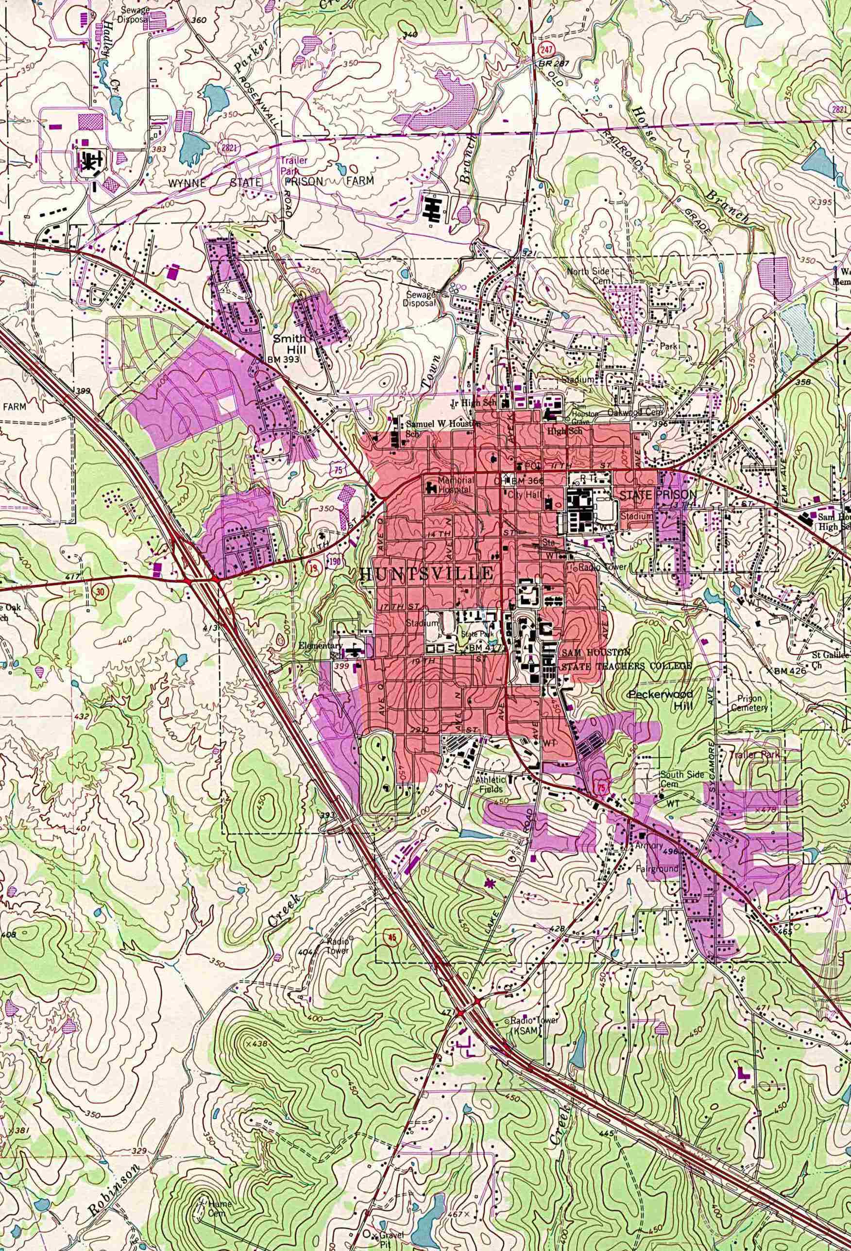
Huntsville - Topographic Map 1:24,000 U.S.G.S. 1963 photo revised 1976 (541K) (University of Texas Map Collection)
Huntsville - Tourist Map [PDF] (Huntsville Chamber of Commerce)
Hutto (Google Maps)
I
Irving (Google Maps)
Irving (Live.com)
J
Jasper (Google Maps)
Jasper - Clickable Street Map (Community Link Cafe)
Jefferson (Yahoo Maps)
Johnson City - Main Routes (Texas Outside)
K
Keller (Greater Keller Chamber of Commerce)
Keller - Interactive Map (City of Keller)
Kerrville (Kerrville Convention and Visitors Bureau)
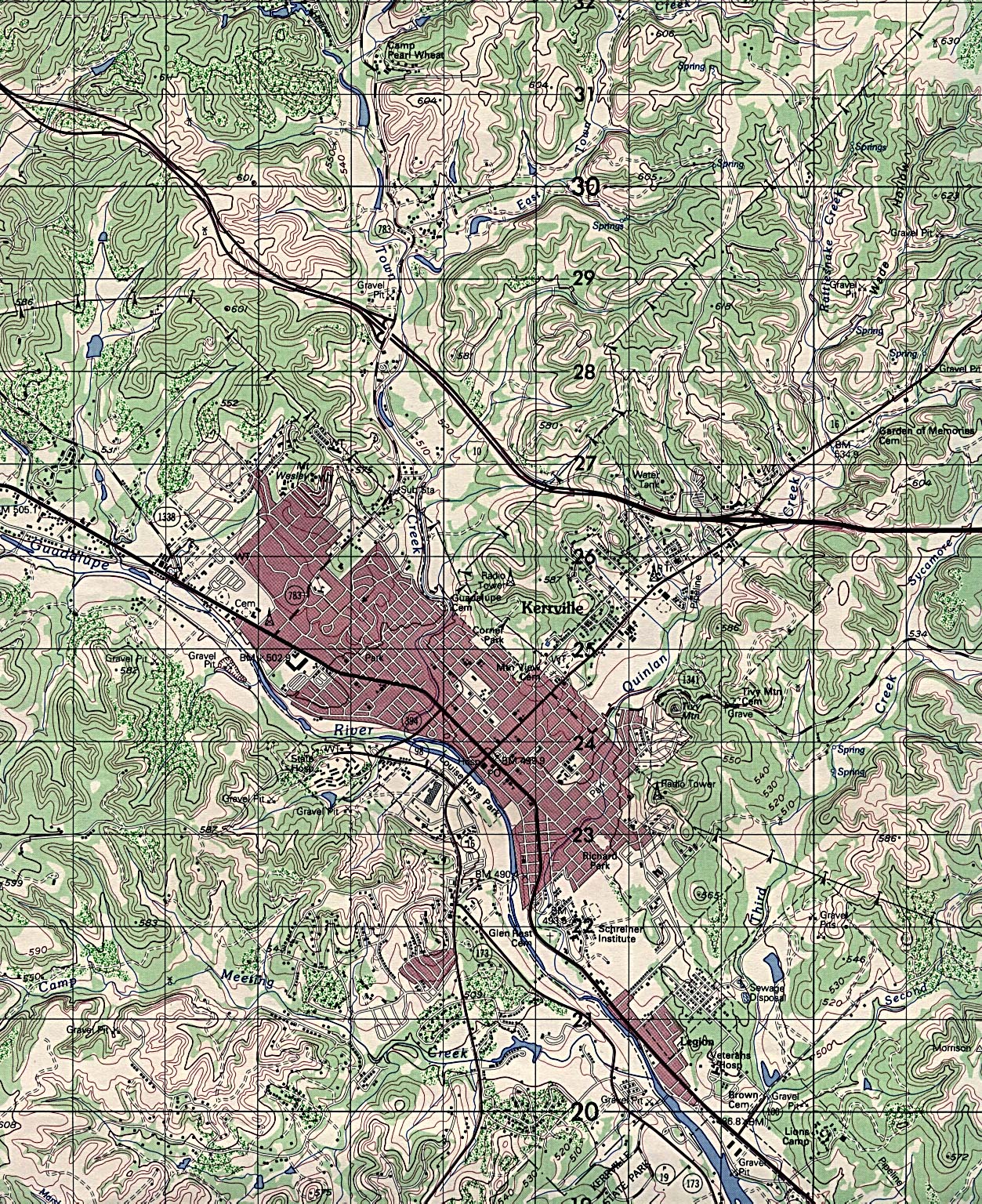
Kerrville - Topographic Map 1:50,000 D.M.A. 1979 (1,063K) (University of Texas Map Collection)
Killeen (Google Maps)
Killeen - GIS Viewer (City of Killeen)
Kingsville (Google Maps)
Kingsville (Yahoo)
Kountze (Google Maps)
L
La Grange (Google Maps)
La Grange (Main Street La Grange)
Laredo (Citiesof.com)
Laredo (Google Maps)
Laredo - Border Downtown Area and Nuevo Laredo (Bat Conservation)
Laredo - Satellite Image (Google Maps)
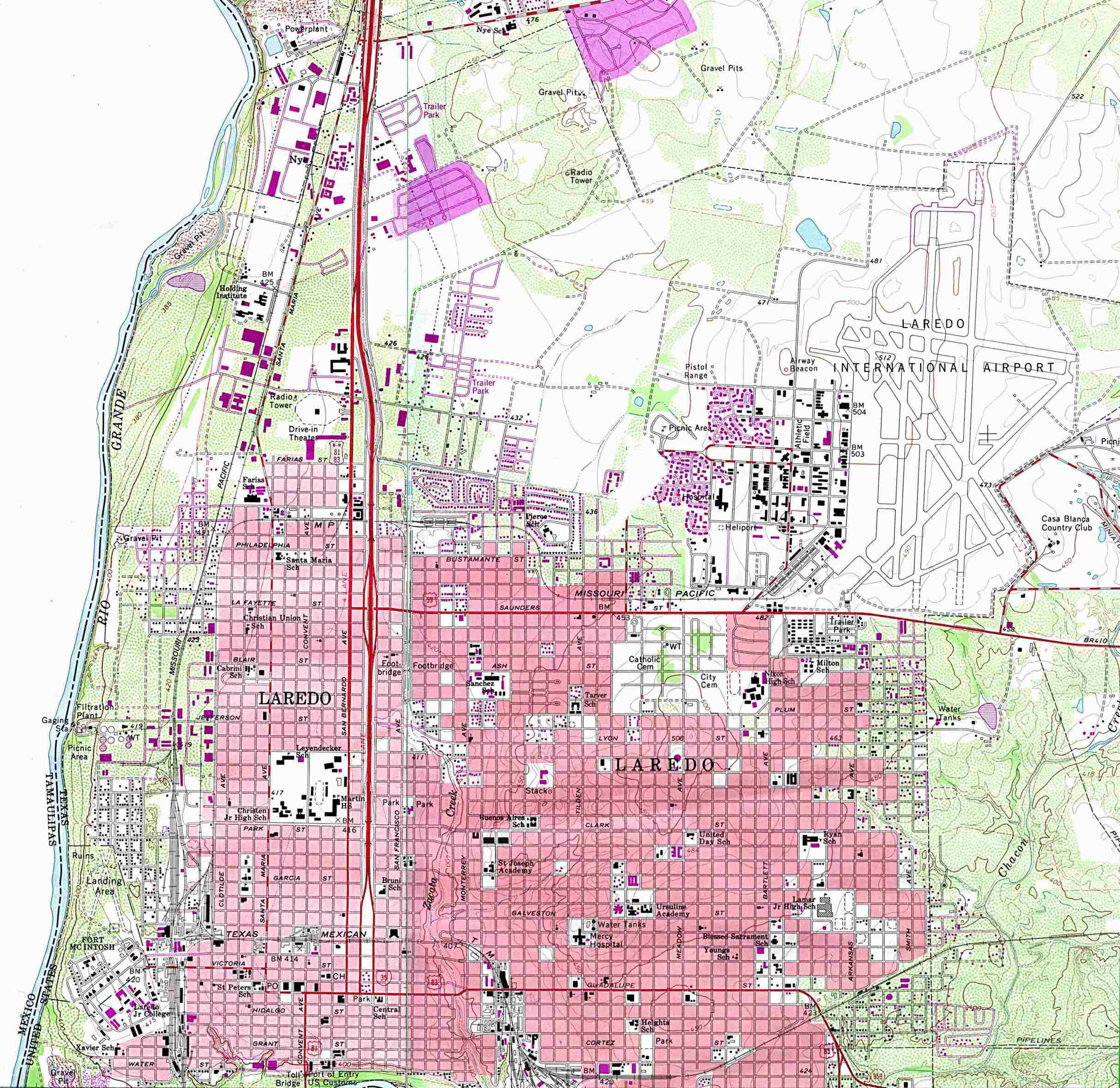
Laredo - Topographic Map 1:24,000 U.S.G.S. 1965 photo revised 1980 (546K) (University of Texas Map Collection)
Leander (Google Maps)
Leander - Maps (City of Leander)
Levelland (Live.com)
Lewisville (Google Maps)
Lewisville (Live.com)
Liberty (Google Maps)
Liberty Hill - Maps (City of Liberty Hill)
Lockhart (Google Maps)
Longview (Google Maps)
Longview (MapQuest)
Longview - Main Routes (Texas Outside)
Lubbock (Google Maps)
Lubbock - GIS and Maps (City of Lubbock)
Lubbock - Main Routes (Lubbock Hospitality)
Lubbock - Texas Tech University Map (Texas Tech University)
Lubbock - Tourist Sites (Texas Outside)
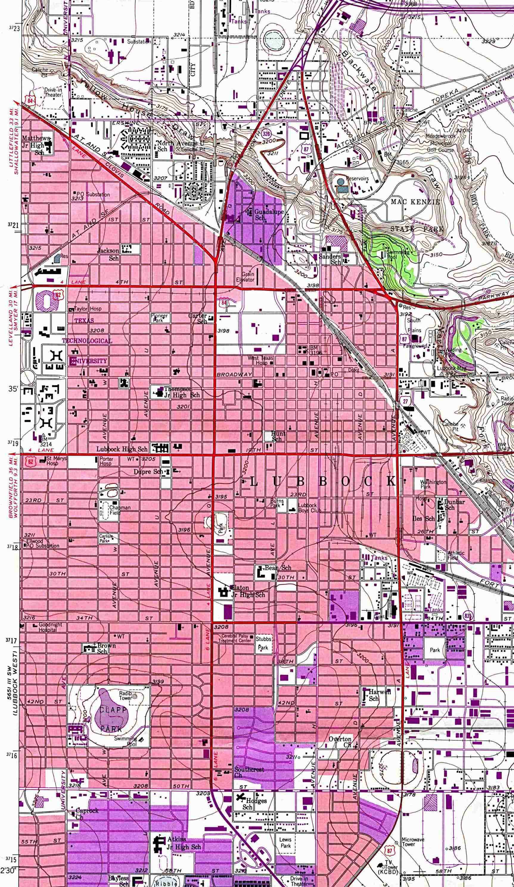
Lubbock East - Topographic Map 1:24,000 U.S.G.S. 1957 photo revised 1970 and 1975 (561K) (University of Texas Map Collection)
Lufkin (Google Maps)
Lufkin - Main Routes (Texas Outside)
Luling (Google Maps)
Lumberton (Google Maps)
M
Mansfield - GIS Data/Maps (City of Mansfield)
Mansfield - Interactive Map (City of Mansfield)
Marfa (Chinati.org)
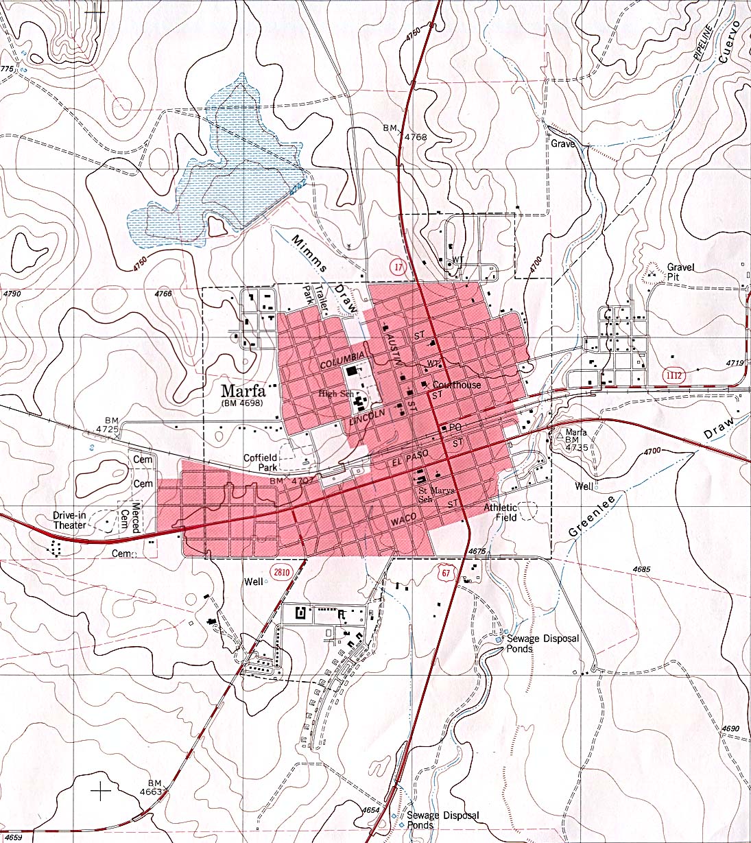
Marfa - Topographic Map 1:24,000 U.S.G.S. 1983 (383K) (University of Texas Map Collection)
Matagorda (Google Maps)
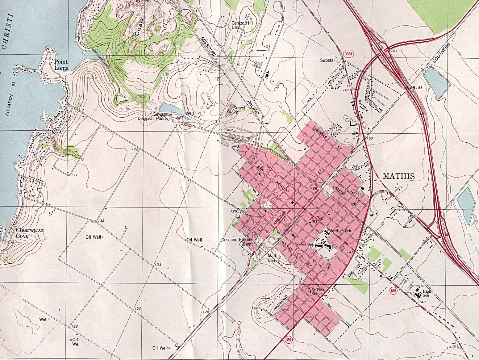
Mathis - Topographic Map 1:24,000 U.S.G.S. 1979 (468K) (University of Texas Map Collection)
McAllen (Google Maps)
McAllen (Yahoo Travel)
McAllen - Main Routes (Texas Outside)
McKinney (Google Maps)
Menard (MenardTexas.com)
Mesquite (Google.com)
Mesquite (Live.com)
Mesquite (MapQuest)
Midland (Google Maps)
Midland (Live.com)
Midland - Maps (City of Midland)
Mount Enterprise - Topographic Map 1:24,000 U.S.G.S. 1984 (544K) (University of Texas Map Collection)
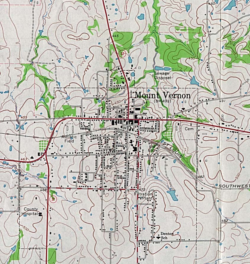
Mount Vernon - Topographic Map 1:24,000 U.S.G.S. 1964 (247K) (University of Texas Map Collection)
Muleshoe - Topographic Map (MapTech)
Murphy - GIS Interactive Map (City of Murphy)
N
Nacogdoches (Google Maps)
Nacogdoches - GIS Viewer (City of Nacogdoches)
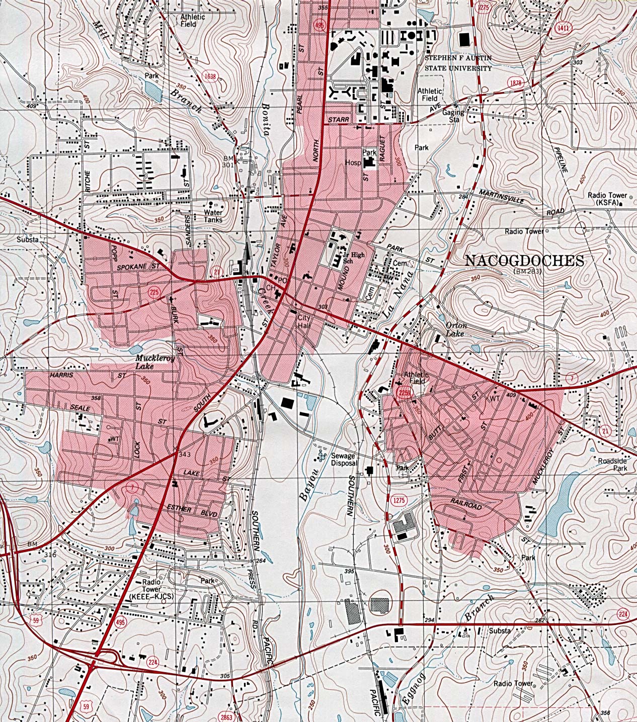
Nacogdoches - Topographic Map 1:24,000 U.S.G.S. 1983 (663K) (University of Texas Map Collection)
New Braunfels (Google Maps)
New Braunfels (Yahoo Travel)
New Braunfels - Clickable Street Map (Community Link Cafe)
New Braunfels - Main Routes (Texas Outside)
Newton (Google Maps)
O
Odessa (Google Maps)
Odessa (University of Texas Map Collection/Texas Dept. of Transportation)
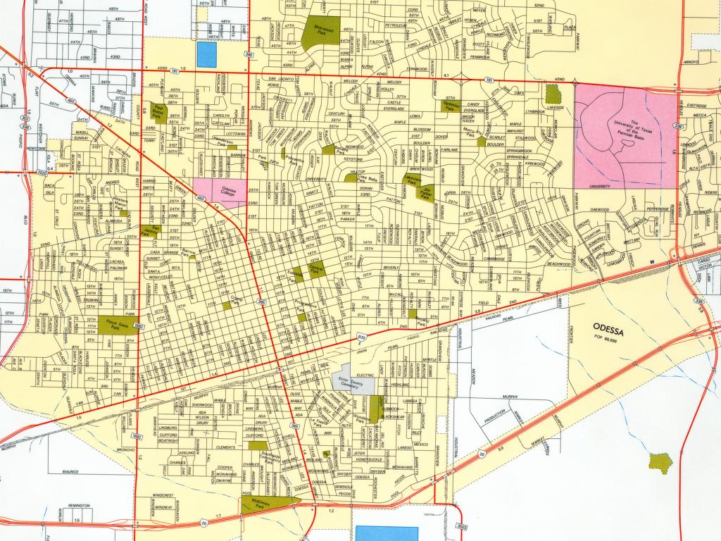
Odessa - Bus Map (City of Odessa)
Orange (Google Maps)
Ozona (Google Maps)
Ozona - Topographic Map (MapTech)
P
Palacios (Google Maps)
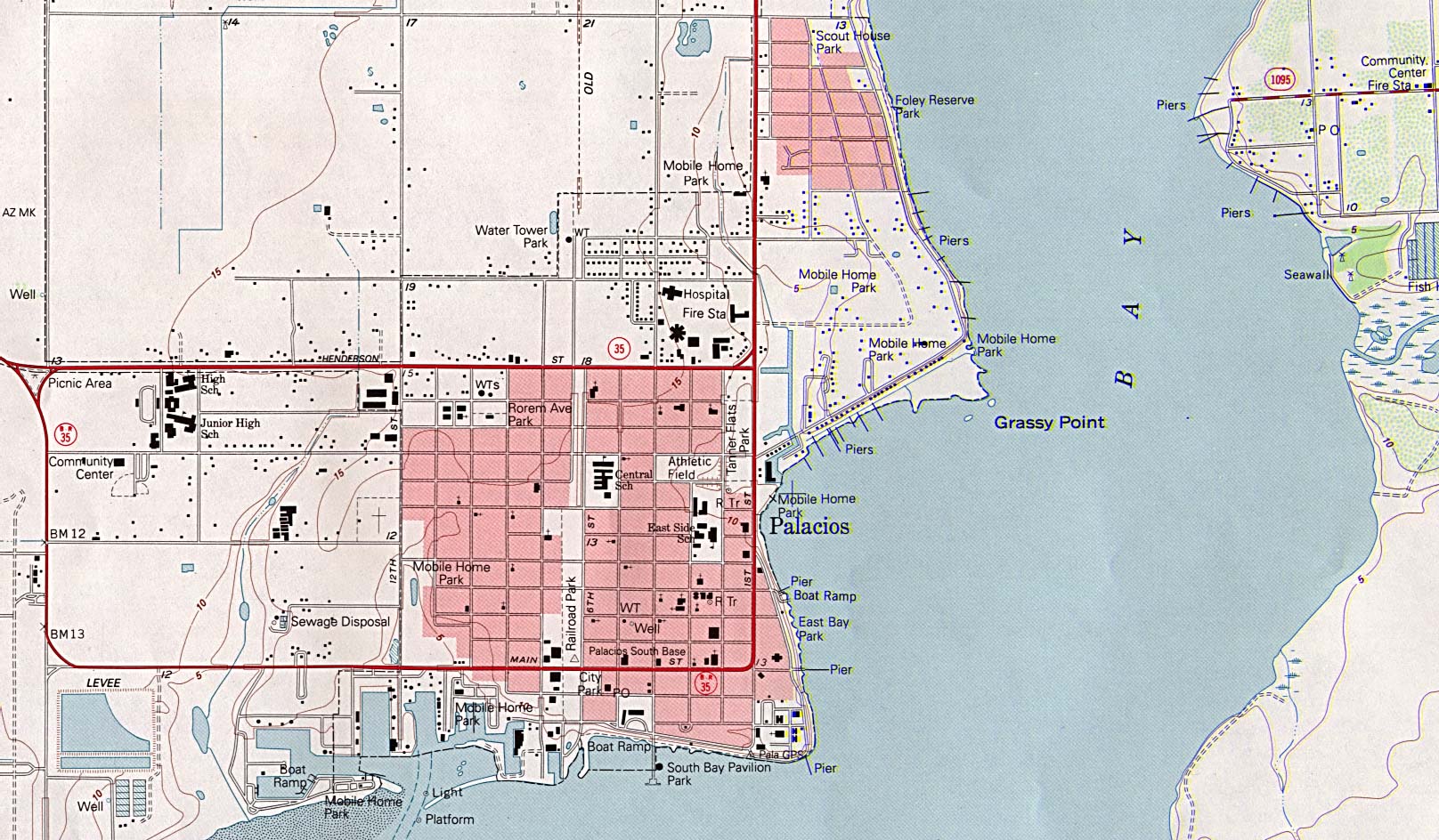
Palacios - Topographic Map 1:24,000 U.S.G.S. 1995 (374K) (University of Texas Map Collection)
Palestine (Google Maps)
Pampa (Google Maps)
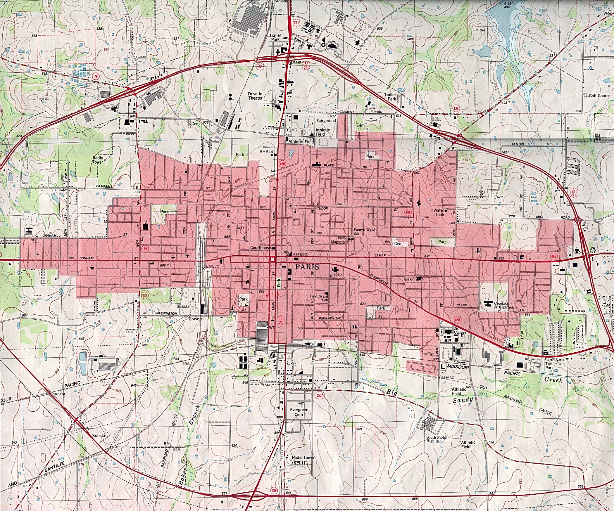
Paris - Topographic Map 1:24,000 U.S.G.S. 1984 (1,097K) (University of Texas Map Collection)
Pasadena (Google Maps)
Pasadena (Live.com)
Pearland - GIS and Maps (City of Pearland)
Perryton - Clickable Street Map (Community Link Cafe)
Pflugerville (Live.com)
Pflugerville - GIS Data (City of Pflugerville)
Pharr (Google Maps)
Plano (Google Maps)
Plano - Clickable Street Map (Community Link Cafe)
Plano - Maps (City of Plano)
Ponder (Sunny's Rainbow)
Port Aransas (Yahoo Travel)
Port Arthur (Google Maps)
Port Arthur - Superfund Sites Map (TNRCC)
Port Lavaca (Google Maps)
Port Neches (Google Maps)
Prairie View (Google Maps)
Presidio, West - Topographic Map 1:24,000 U.S.G.S. 1979 (247K) (University of Texas Map Collection)
R
Richardson (Google Maps)
Richardson - Topographic Map (TopoZone)
Rockdale (Google Maps)
Rockport (Google Maps)
Round Rock (Google Maps)
Round Rock - GIS Site (City of Round Rock)
Round Rock (interactive map) (Yahoo Maps)
Rusk (Google Maps)
S
San Angelo (Live.com)
San Angelo - GIS/Maps (City of San Angelo)
San Antonio (Google Maps)
San Antonio (Lonely Planet)
San Antonio (Yahoo Travel)
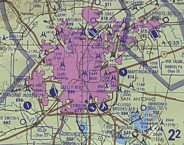
San Antonio (aeronautical) 1:500,000 D.M.A. 1989 (174K) Not for navigational use (University of Texas Map Collection)
San Antonio - Clickable Map (Johnny Road Trip)
San Antonio - Bus Route Map - Interactive (VIA)
San Antonio - Crime Maps (San Antonio Police Department)
San Antonio - Downtown (Johnnyroadtrip.com)
San Antonio - Freeway Maps (Texas HighwayMan)
San Antonio - GIS Mapping Application (City of San Antonio)
San Antonio - Main routes (Brooks AFB)
San Antonio - Main Routes (Johnnyroadtrip.com)
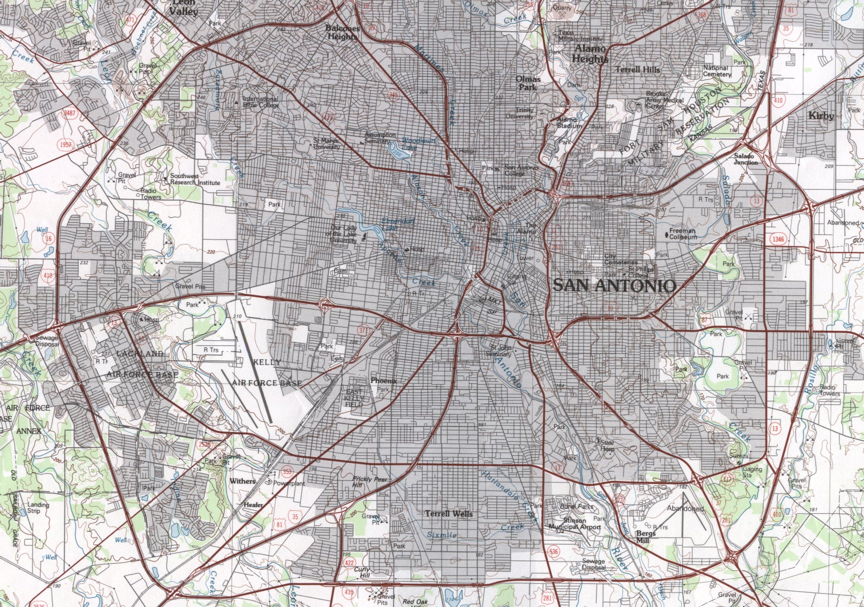
San Antonio (planimetric) 1:100,000 U.S.G.S. 1985 (888k) (University of Texas Map Collection)
San Antonio - Tourist Sites (Texas Outside)
San Antonio - Superfund Sites Map (TNRCC)
San Antonio - Traffic Map (TransGuide)
San Augustine (Google Maps)
San Marcos - GIS WebMap (City of San Marcos)
San Marcos - Main Routes (Texas Outside)
San Marcos - Texas State University Maps (Texas State University)
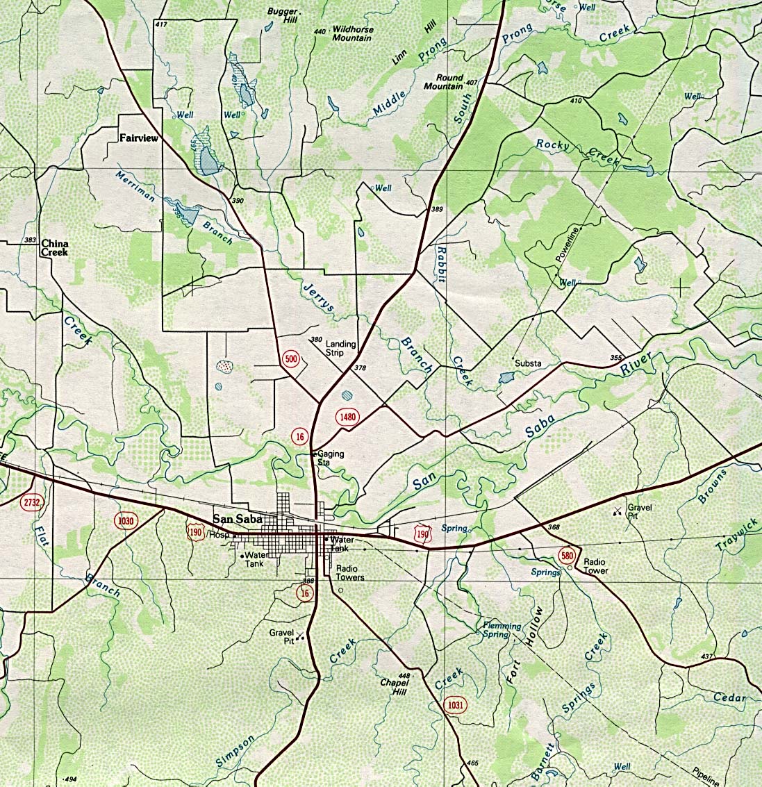
San Saba (planimetric) 1:100,000 U.S.G.S. 1985 (374K) (University of Texas Map Collection)
Seguin - Main Routes (Texas Outside)
Silsbee (Google Maps)
Smithville [pdf format] (Texas Parks and Wildlife)
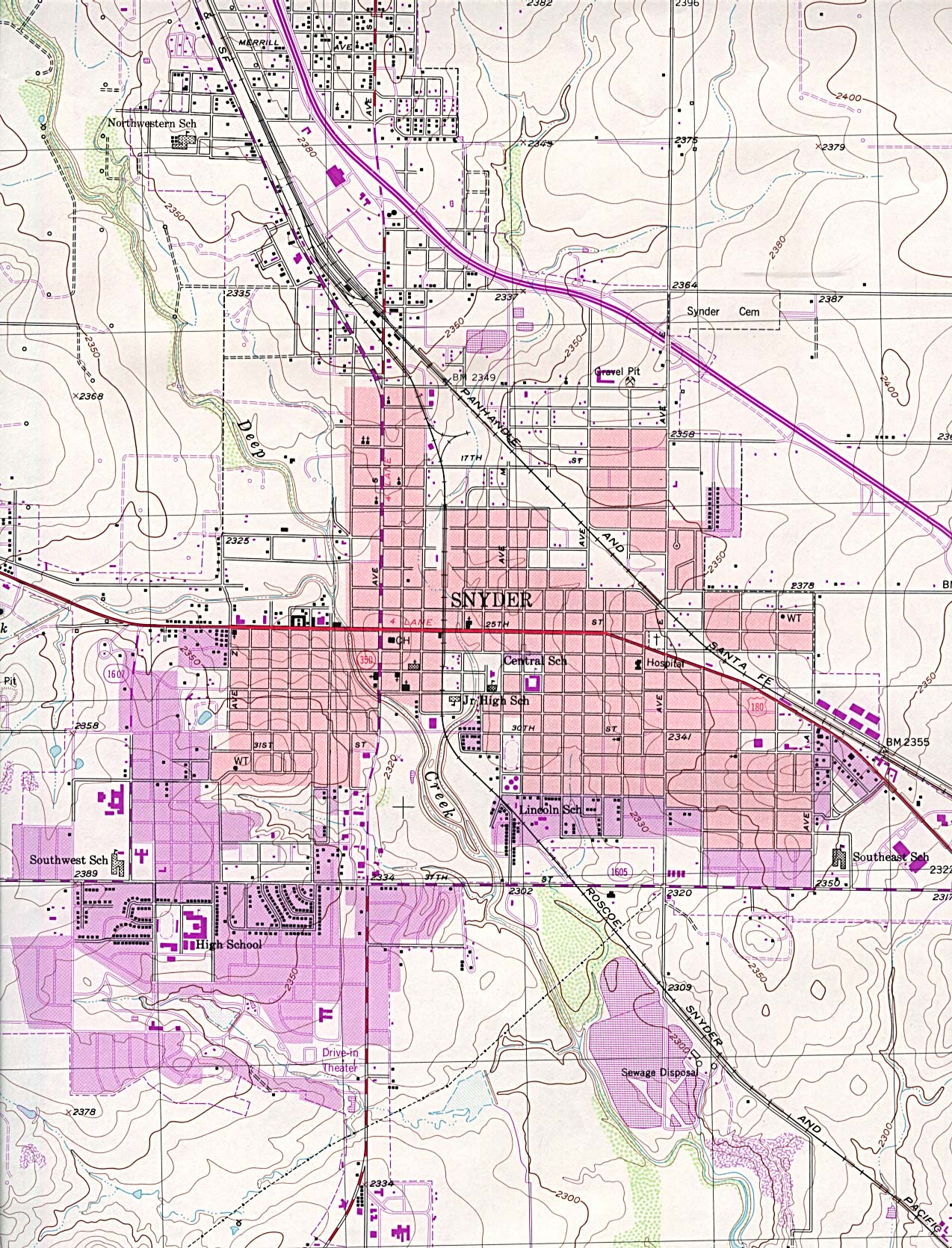
Snyder - Topographic Map 1:24,000 U.S.G.S. 1979 (626K) (University of Texas Map Collection)
South Padre Island [PDF] (Town of South Padre Island)
South Padre Island (Yahoo Travel)
Stephenville - Clickable Street Map (Community Link Cafe)s
Sugar Land (Google Maps)
Surfside Beach (Google Maps)
Sweetwater (Live.com)
T
Taylor (Google Maps)
Temple 1996 (210K) (University of Texas Map Collection/Texas Dept. of Transportation)
Temple (Live.com)
Terlingua (TopoZone)
Texarkana - Main Routes (Texas Outside)
Texas City (Google Maps)
Texas City - Galveston - Houston Metropolitan Map 2001 (590K) (University of Texas Map Collection/Texas Dept. of Transportation)
Tyler (Live.com)
Tyler - GIS (City of Tyler)
Tyler - Tourist Map [pdf format] (Tyler Convention and Visitors Bureau)
U
Uvalde (Google Maps)
V
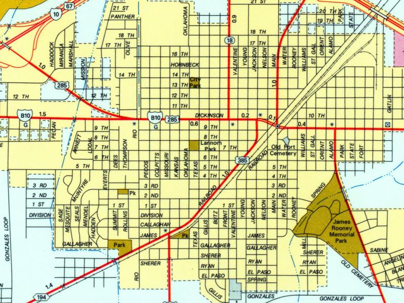
Vernon (Google Maps)
Victoria (Live.com)
Victoria (Google Maps)
Victoria - Main Routes (Texas Outside)
W
Waco (Google Maps)
Waco - Main Routes (Texas Outside)
Waco Map (Waco CVB)
Weatherford [pdf format] (Rustbelt Cartography)
Wharton (Google Maps)
Wichita Falls (Google Maps)
Wichita Falls - Clickable Street Map (Community Link Cafe)
Wichita Falls - Topographic Map (Live.com)
The Woodlands (Google Maps)
Y
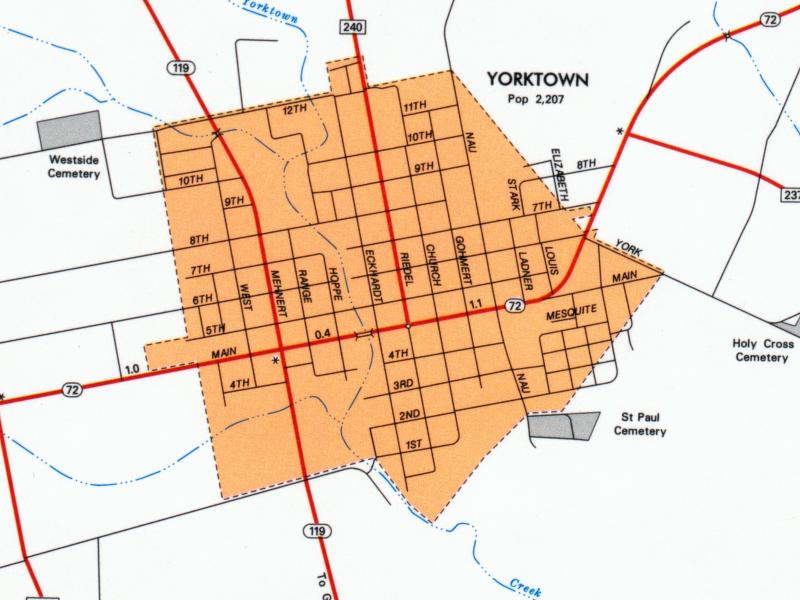
Yorktown (University of Texas Map Collection/Texas Dept. of Transportation)
Z
Zapata - Topographic Map (Live.com)